After we have gained so much info from many peoples travel stories over the years, we hope that we can help anyone who would like to get out and do some of the things they have always dreamed of.
After the spectacular hike to Lake O'Hara in such beautiful blue, clear weather, we pack up the trailer and drive to Golden, BC. We really have not done a lot of hiking or MTB in this area so we thought we would poke around a bit and see what we could find. Dave, in the past, when he was really dumb and foolish, paraglided off Mt. Seven, which is just above the town, a number of times throughout the years.
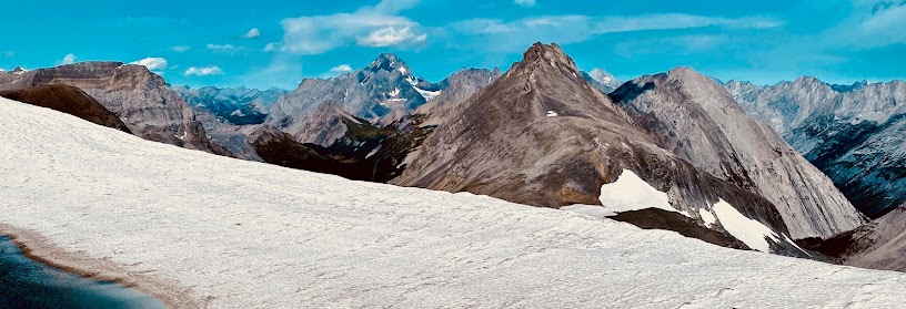
Looking across the Columbia River valley to the Rocky Mountains. Golden is just out of sight to the right.Set up the trailer at the municipal canmpground and started exploring. One hike that we thought might be kinda fun was to ridge walk from the top of the gondola at Kicking Horse Resort. Tried to hike up and then take the godola down but they were going to charge us almost the same as a round trip so here we are getting whisked up to the top in fine style with all of the other down hill MTB and tourists.
Pat starting out to the north of the gondola on a nice path. Fine views of the Purcell Mountains to the west.
Mountains to the west for hundreds of km and no one around.
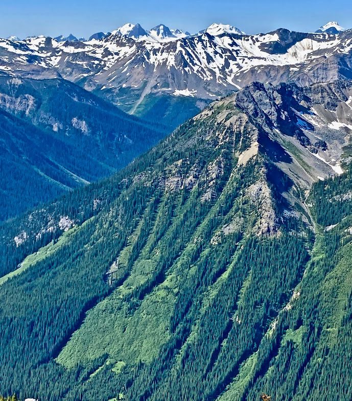
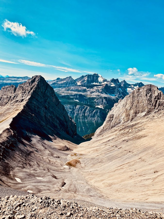
A view looking north along the ridge that heads to the Gormon Lake TH. We plan to do this hike which takes you along the ridge as far as you can see, then bears right down to Gorman Lake.
Some of the mountains in the background are in the Glacier National Park
Part of the Sawtooth Range in the top background.
We are still heading out to the north as the ridge starts getting rougher.
Looking back from where we have come.
End of the Sawtooth Range and views of the Rocky Mountains across the Columbia River valley.
Mt. Sir Donald in the background, situated in Glacier NP
You can really get a nice view of mountains 360'
Only saw 1 other couple on this hike and the weather was spectacular. Lunch time on one of the 4 mini peaks along the ridge.
We could not go up in the gondola until 10:00 and had to be back before 4:00 so it did not gives us much time to head out and back along the ridge.
Looking south east to the 3 Goodsirs mountains in Yoho NP.
Mountains in Glacier NP.
Back before 4:00 at the top of the gondola looking at the upper downhill MTB trails.
Last look at the "Rockies" to the east. We pack up the trailer and drive back to Vernon. We definately will be back to MTB and hike in the Golden area. Maybe even canoe the Columbia River if we can stand the mossies.
Looks like todays ride will be Beowulf, a 36km, 4300' vertical, MTB loop , rated black,(2 have died on the circuit), up at Silver Star Resort above Vernon, BC. Pat and BIL Tom getting ready for the ride.
We ride up through the alpine area to the official start of the epic trail.
5 of us are riding today. Tom V and Tom S with E-MTB, Sandra, Pat and Dave on regular MTB.
After it seems, thousands of switchback, we hit rock bottom. This is the creek crossing that is at the lowest point of the trip.
Typical vegitation at this elevation along a creek.
In these dense cedar stands, daylight has a problem getting through the canopy. Fuelling up before the 1 1/2 hour grind to the top.
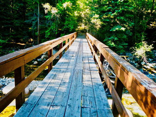
Right after crossing this bridge, the going gets very steep coming this way. Dave was the last to make it to the truck. The 2 boys with the e-bikes had no problems and Sandra and Pat, strong riders went ahead but Pat, bless her soul, came back and rode with Dave.
Todays hike is up to an old Forest Service Fire Lookout called Eagle Pass Mountain. The 14km road especially towards the end is very rough. Here is Jose' getting ready for the medium length, steep hike.
The steep hike passes through an old growth forest before breaking out into the sub alpine. The lookout is perched on a rocky knoll at the top of the mountain.
Looking up to Eagle Pass.
Views to the east as we climb up the steep rocky trail.
Tom and Jose hike to the end of the ridge.
The roof has been replaced a few years ago and is good for overnight stays.
These are the Selkirk Mountains fairly close to Revelstoke.
Looking towards Glacier National Park
We hitch up the trailer and head to Blanket Creek PP which is south of Revelstoke on hwy#23 on the way to the Shelter Bay ferry.
A bit of a gloomy day, no hiking. This is the day area with the lagoon swimming pool next to the very high water level Arrow Lakes. There has been a high rate of water release at the Revelstoke Dam due to high snow melt.
Beautiful day for a hike. Have wanted to do this one for awhile and it is an all dayer.
Bob checking out the creek coming down from the snowfields.The forest is mainly cedars being that it is so wet in the Revelstoke area.
This is a cabin where the horses were kept when they did the 2 day trip with supplies for the Fire Lookout at the top of the mountain.
We got side tracked at the beginning going up the new MTB climb trail at the TH. In the end, we will have hiked close to 32km and 7300' vertical, the most elevation gained I think we have ever hiked in a day.
Great views of the Selkirks across the valley
Looking north east towards the Revelstoke Ski Resort.
Hiking up the ridge to the rocky top of Mt Cartier. You can just make out the tiny white dot near the right of the summit which is the Fire Lookout.
Looking east to the mountains near Glacier NP.
Made it at last. We were past by 4 hikers coming down, lots of MTB who had been heli lifted to the top and were riding down, saw a paraglider who also was brought in by helicopter.
Bob and Jose' enjoying lunch with Mollie looking to clean up the scraps. View looking down the Arrow Lakes which is really part of the Columbia River dammed at Castlegar.
Not sure which mountain this is but it might be Blanket mountain and home to a ski touring lodge that takes guests up onto the Blanket glacier.
These are some of the mountain ranges that are to the east and eventually runs into Glacier National Park.
Mt. Begbie, a famous local backpack/hike/climb.
Revelstoke and the river crossing in the lower left with Selkirk Mountains as a backdrop
Pat scrambling down a steep rocky cliff
Jose hiking along an exposed trail that leads from the lookout.
You can see the white post that has a thin wire to keep people from falling off the shear cliff band.
On our way back down off of the rocky peak to the big switch backs that traverse the avalanche slopes. Just past Pat near a snowy patch, is where the helicopter lands to drop off MTB, paragliders etc.
Looking over to Mt. McKenzie where the Revelstoke Ski Resort is located.
A last look at the Fire Lookout on the top of Mt. Cartier. The trail to the lookout is about halfway up on that dark triangular cap at the top of the photo. We were passed as we headed down, by 4 MTB who had pushed/ridden their bikes all the way from the bottom. It was a long trip back but the weather was good and we all were glad that we put the effort into this hike.
Todays hike will be from the Mt. Revelstoke parking area. This is an extremely popular area because you can drive all the way to the top before hiking. Because no dogs are allowed on the Mt Revelstoke NP trails, Bob and Mollie had to hike on the trail which follows the paved road up to the fire lookout area. Jose, Pat and Dave hike to Eva Lake.
We wanted to do a curcuit of the 3 lakes rather than an out and back so halfway around Eva Lake, we started hiking up to a pass.
We didn't know if this was the right route as we hadn't tried this before.
We kept climbing over rock ruble and avalanche slopes until we got to a basin. We didn't know it at the time but the actual pass that we were aiming for is the small, low spot on the dark rock in the centre of the photo.
Looking for ways out of this basin, but the routes above looked kinda steep.
Bingo. Just ahead of the girls, is the pass we are looking for.
Looking down from the pass at the valley where the Jade lakes are. (Below Inverness SW4 in the background.)
Looking east from Jade Pass is Inverness Peaks which is still in the Mt. Revelstoke NP.
A view back to Jade Pass around this rock band, from where we have just hiked from.
Heading down to Miller Lake with Mt Revelstoke NP tourist information area on the lower ridge, in the background and ending back up at the truck. After Mt. Cartier the day before, this was a fairly long, but easy curcuit hike. On todays program is Frisby ridge. We have ridden this very popular local MTB ride a few times. Takes us about 1.5 hours to get to the lookout area above the lake. There is a lake below the lookout which adds another .5 hour onto the total trip. There is another 7km section past here, that we haven't ridden yet. Here's Dave grinding up the last bit of the trail to the lookout. Bit of an overcast day which is perfect for riding but photos not as colourful.
We take in some of the great mountain shots from this high point.
Lake Revelstoke, just a dammed section of the Columbia River, is at the bottom of these snowy peaks.
There are snow covered mountains all around us.
This is a blue trail with not a lot of technical features but it is a long enough hump up to the high point to keep away some bikers who are not used to the uphill grind. And, no E-Bikes so you have to do all the work.
One last look at the scenery before the fast pounding downhill run back to the TH. The total lenght is 12km and elevation gain 830m. (2740')
Say goodbye to Bob and Jose, pack up the trailer, leave Blanket PP and head off to Golden for a bit of lunch.
Turn right at Golden and head down to Cranbrook following the Columbia river. Pull into Wasa Lake CG, 15km north of Cranbrook.
Fairly quiet due to the cool weather. No boats on the lake and campground has lots of openings.
To stretch the legs, we take our MTB and ride around the lake. We will be scrambling up the mountains you see in the background tomorrow.
As usual, lots of physical activity means lots of good food.
Todays fun is a hike/scramble up Mt. Fisher. Getting to the trailhead features a very rough and narrow road. We have been here before. We first wanted to climb to the top after seeing the Stanley Cup being hoisted by Rob Niedermeiyer , a Cranbrook native, after being dropped off by a chopper.
The trail was an original climbing route, so very steep and rough.
There is a trail somewhere in all of those boulders.
Mt. Fisher. Of course, even though it is a bit of a scramble at the top, the back side, where we will go up, is really only a rough, steep hike
Working our way through the snow and dead falls.
This is the entry basin before getting up to the ridge which is the pass between the ridge peak and the jagged rock to the right.
There was a lot more snow now than there was the last time we were here and we were lucky that the very steep snow slopes we had to cross were short. We have just arrived at the pass.
0
Still a fair bit of snow especially on the north side.
A view from the pass looking down the way we came up. Down below in the valley is Fort Steele and the St. Mary's, Kootenay rivers and Boulder Creek.
Mount Patmore.
Snow fields looking down from the north side of Mt Fisher
A closer look at the valley and Ft. Steele at the confluence of the St. Mary's and Kootenay rivers.
A rugged ridge coming off Mt Fisher.
Walking through more snow
The descent is a real knee knacker as flood waters have washed away large tracks of the trail.
Move the trailer over to Jim Smith PP 4 km south of Cranbrook.
This is the lake by the PP which because it is so shallow, has fairly warm water for swimming. We pack up and decide to head home as Pat will drive up to Smithers, an 11 hour drive to see Andrew, Sue and the 2 grand kids for a week.
Dave will go backpacking up to Cathedral Lakes PP. The last time he and Pat were backpacking was 4 years before when they went on a 4 day Grand Canyon hike from Lipan Point to the New Hance trail head with a side trip to the Little Colorado River. This is the bridge crossing the Ashinola river at the TH.
Dave stopping for some refreshments on the way. To get ready for the trip Dave spent 5 x 1.5hr hikes with a 48lb pack in Kalamalka Lake PP which is fairly hilly.
Looking at the destination point which is the mountains in the background. This fairly good trail is 16km and 4300' vertical one way.
The day was pretty hot. Most people go in and out on a shuttle but this is not the way for Dave and anyways, the shuttles have been booked long in advance.
Made it to the main campsite at Quinisco Lake in 6 hours going fairly steadily. Carried a 48lb pack which is too heavy even for a 6 day hike. Will try and trim it down next time.
All of the day hikes start off from this campground. One of the hikes goes around the lake and up to the pass at the upper center of the photo.
The MSR HubbaHubba tent is set up and campsite looks comfortable. This was a tough hike especially for those who are not used to this elevation gain. Most of the hikers Dave passed up or down were at least 40 years younger.
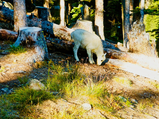
At night the local group of nanny/kid mountain goats would frolic amongst the tents. One thing these goats liked to do was to lick the urine from around the tents from those nightly nature calls.
Even though Dave was tired from the day before backpack, he decided to go for a day hike. The CG was at 6800' and the highest point in the whole Provincial Park is 8600'. That is only 1800' vertical to the highest point in the park.
Todays hike goes up behind the campground and heads steeply up to Glacier Lake. The trail continues to a high point above the lake where this photo was taken.
Looking towards the west there are numerous higher mountains of the north Cascades.
Looking down at Ladyslipper Lake from Stone City on the ridge hike.
One of the many cliff as you head towards GrimFace.
Grimface Mt. which is a class 4 scramble is in the background.
Grimface a little closer. Nice rockbands as you hike along the high country.
Nice steep rock bands as you hike along the top.
Looking up to to high plateau areas above Ladyslipper Lake which Dave hiked a number of hours before. After dropping down a lot of elevation, the trail follows the shorline of the lake, gains some elevation and then drops down to a valley where the trail passes Pyramid and Lake of the Woods lakes before heading back to the campsite.
Heading up over a saddle from Ladyslipper lake. with the mountains I have traversed in the background.
Todays hike takes us by Lake of theWoods and then onward to Goat Lake which is just to the left of this view of the headwall.
Goat Lake looking back from where I have come.
Views of the headwall from Lakeview Mt.
Looking across from the plateau as Dave traverses the high country
Looking west at some of the mountains of the North Cascade.
More of the same.
Lake of the Woods which is the other campsite 2 km from Quiniscoe Lake.
Such a quiet and pretty spot to camp compared to Quiniscoe Lake. Next day, Dave takes 4 hours to hike out of the Cathedrals and drives through a lot of smoke from fires across Skaha Lake which were started by lightening.
Our next trip means we hitch up the trailer and drive to Castlegar to check out the MTB trails. We stay at the municipal Pass Creek campground. Decided to do a little exploring around the town and stopped at Millenium Park which is on the Columbia River.
Todays ride takes us to Merry Creek Forest Service Road, kinda south of town. Thought we would try the trails on the lower side of the TH to warm up which are the Merry Creek Trails..
Fairly easy, single track with some climbing.
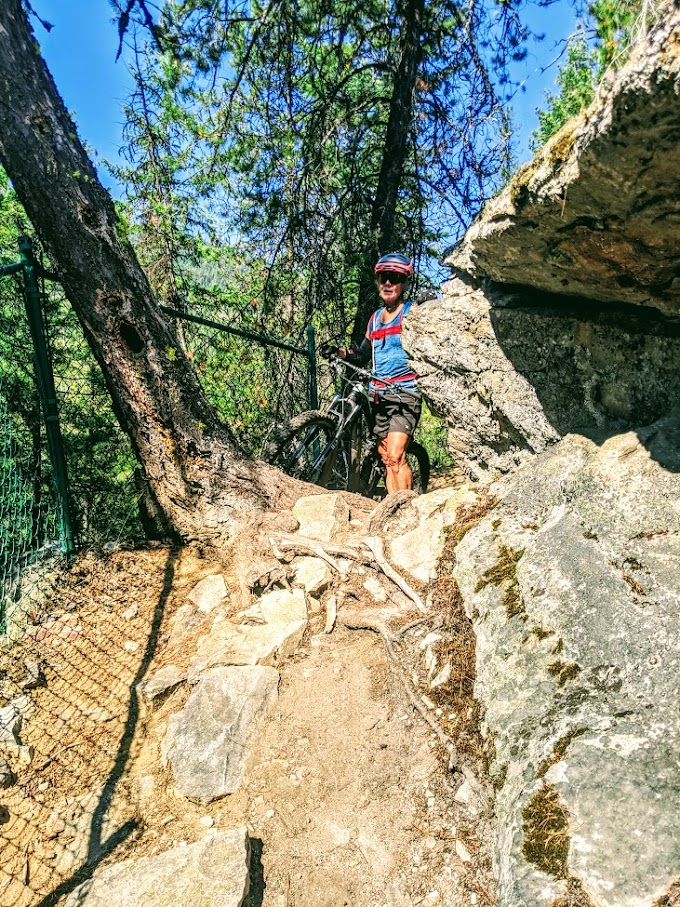
Then we took the wrong turn and suddenly, we were on a steep hiking area where a few places were above our pay grade
After completing the whole lower curcuit, we head up the trails which are on the upperside of the TH which is Merry Go Round. This is a bridge over one of the creeks.The lower side switch backs were fairly difficult to ascend. We found out later, there is a parking area at the top of this trail so some use our accent trail to descend after shuttling.
Made it to the midway TH which is also a parking area of Mr. Green Jeans. From the parking area, the ascent was easier than the lower part even though they are both blue trails. Make it up 2/3 to the top before Dave said he was getting tired, poor baby.
Dropping down the trail, we take a photo of a bit of Castlgar and the Columbia river.
Todays hike will take us up to the historic "Old Glory" mine trail and Fire Lookout which is just up the road from Red Mountain, out of Rossland. Since we are in pretty good hiking shape, the hike up to the ridge is not too difficult but then we have to descent to the valley and then climb up a ridge to the lookout.
This is what is left of some mine buildings which are just below the Fire Lookout.
This a fairly new Lookout compared to some of the rock foundation ones we have hiked to over the last few months.
This was a weekend in the summer and we were surprised at how many hikers made it to the Lookout. We took a different route back to the truck which included walking on a part of the Seven Summits MTB trail. Very cool. That legendary MTB traverse is on out list.
When you are out almost every day, hiking and biking, sometimes for long long days, it sure is nice to come back to good grub and drinks.
Simple "comfort food". Next day we hitch up the trailer and head to Canmore and stay at a friends place.
We park the trailer at a friends house in Canmore and while Pat does some training with her friend, Dave heads out to meet some hikers from Manitoba.
They suggested Mount St Piran which Dave had never heard of even though it was right next to Lake Louise.
Unfortunately it was kind of a cloudy day so the mountains were always shrouded in clouds. The hike up to Lake Agnes tea house was as usual, a zoo, it being a Sunday. This is Lake Agnes and the trail that goes up to the "Beehive".
Once we left from the tea house and started up to the little beehive, we dropped most of the hikers. Shortly after, we started up on the trail to Mt. St Parin and there were just a few hikers.
Dave knew there was a round trip going down the backside of the mountain according to Alltrails and he asked the 2 other hikers if they wanted to do the round trip but because they were a little more unsure of the terrain, they declined.
Dave coming down the backside onto Lake Agnes. Pretty steep ground. Saw no one until coming to the junction of the trail going to the Beehive.
We always wanted to hike the "Northover route" which is in Peter Loughheed PP, so we packed up the trailer and drove to the Boulton Campground. We know this area quite well, having done numerous hikes in the area over the years. We were looking for the perfect, sunny day due to good photo opportunities which was not for a few days. Here is Pat checking out the scenery ay Upper Kananaskas Lake.
The Northover route is a 3 to 4 day backpack hike normally, 33.2km and 2171m elevation gain. It is supposed to take 12+ hours for very fit hikers who are experienced to hike this in 1 day. To help us a bit, we dropped MTB at the bridge on the way to the Forks CG which saved us around 8km although, because we started at the Rawson Lake TH on the upper Lake, we ended up walking over 28km.
A perfect day for a hike. The night before had strong wind. Really pity any one who was trying to hike the ridge in that wind. Got a 6:30am start, no one at the TH. We have been on a one day hike up to Aster Lake a few years before so we were familiar with the route up to this point. Trail along the lake is quite straight forward but as soon as you leave the main trail, things get a little rough. Hidden Lake is in the foreground.
This is some of the terrain that you have to hike through on the way to Aster Lake
Somewhere around the centre left of the photo is where we dropped our bikes. Mt. Indefagitable and Invincible are across Upper Kananaskas lake.
Aster Lake is over the hill in front of Pat. We will eventually be hiking up to the pass to the left of the mountains in the back ground.
Aster Creek waterfall coming down the headwall below Aster Lake.
Last look down the valley before heading to Aster Lake. You can make out the steep trail that comes up from Hidden Lake. To the right, out of the photo, is the headwall which has short, mild exposure.
Aster Lake is just over the rocks in front of us. The route heads up the scree valley in the upper right.
Mt. Northover. The route passes to the west of this peak. For some who have the extra time when backpacking, this summit makes for a good moderate scramble.
We are looking at the "Royal Group" of mountains to the NW which are in BC as well as the small tarns below us.To our right, upper ridge, is the Northover route
Looking back at the pass which is to the left out of sight. Warrior Mt.? is the black peak.
Mt. King George on the other side of the Palliser river valley.
We are now traversing the Northover Ridge with views to the north of endless mountains. Wind is quite strong and steady as we make our way along the ridge which is usually the norm.
We pass a group coming down who had camped at Aster Lake the night before. They had tryed to cross the ridge that day but were blasted off by the high winds which hit that area the same time we were experiencing high winds at the Boulton CG yesterday evening.
Almost at the top of the ridge after hiking up some switch backs on scree. You just make out the faint trail that traverses above the 2 tarns and climbs over the low ridge in the upper left. Warrior and Waka Nambe Mts. in the background.
The ridge makes up the BC/Alberta border and slowly climbs to a high point.
Always spectacular all along the ridge. We passed a group stayng 2 nights at the Aster CG and a few single hikers up on the ridge at this time. This was the first nice day so we we expecting a fair few hikers. The amount of traffic on this route is limited due to reservations at the campsites are regulated.
We have hiked many of the trails to the east of here during our Great Divide through hike and hiked the South and North Kananaskas Passes curcuits. Pat has also been up on the Haig Glacier a number of times with Cross country ski athletes in the summer. We were warned of a couple of sketchy spots on this route where some backpackers had to crawl over a short section of exposure. Not sure if it was because of wind and the top heavy pack.
The only section we found that was a bit scary was on the ridge in the upper left and it was a short narrow section that was steep glacier on one side and a steep drop off on the other.
After a steep drop down to the saddle on the left, it is more scree downclimbing on the way to 3 Isle lake.
Pat on her way to the high point of the route which is just past the last bit of snow, around 2790m.
First views of 3 Isle Lakes. From these lakes, it is a steep trail down over a headwall before arriving at the "Forks" campsite.
Working our way up to the highest point on the Northover route.
Looking back up the ridge on our way down.
We have hiked a lot of vertical and also a fair few km. Mostly downhill from here.
In the background is Mt. Sir Douglas and the Haig glacier where cross country ski athletes train. We have hiked this area a number of times. The south Kananaskas pass in just past Mt. Beatty.
Somewhere below on all that scree is the switch back trail that take us to 3 Isles Lake. The valley directly through the centre of the photo is where the Palisser river flows. If you follow it up the valley, eventually, it takes you over Palliser Pass and into Banff National Park. This is part of the Great Divide Trail route.
The trip back to our bikes past 3 Isles Lake and the Forks was uneventful. Met some backpackers coming up the steep trail to overnight at the lake. Rode our stashed MTB back 8km to the truck and then drove back to our campsite at Canyon, or so we thought. Ended up in a big line up of vehicles. There had been an accident where a motorcycle went off the road and driver was killed. No one moved for over 3.5 hours. Of course we were pretty tired, dehydrated and hungry so Dave pedalled back to the Boulton store and bought some junk food and drinks. We sat awhile and then Pat decided to get her bike out of the truck and cycle 20 minutes down the road to our campsite to prepare a meal so when Dave could get moving after the traffic jam, supper would be ready. She rode 2 km to the accident where an RCMP person said no one was passing. Eventually they let her go and she had to dodge 8 grizzlies(sows with cubs) who were eating Buffalo berries beside the road. She had no bear spray. She finally made it back to campsite, prepared food and waited. Of course there is no cell service in this area. Dave finally got home around 10:00PM, tired, thirsty and ravenous. It was one of the longest one day trips we have ever been on but so worth it. No wonder all the hikers on the route looked like our kids.
Dave decided to do some hiking and biking in the Valemont area. We had planned to do it for the whole summer but weather in the area was terrible. Looks like there was a going to be a week of good weather. Took a camping spot at Mt Robson Meadows. Plan was to do a day hike to Berg Lake and then head back to Valemont to meet my son, DIL and the 2 grandkids who were on their way back from a trip to Smithers. This is a shot of Mt. Robson on Friday evening.
Set up camp at the Robson Meadows CG. Place was almost deserted. They were shutting down most of the sections of the campground due to declining occupation.
Nice to have a real fire again. Most of the summer, we have been using our propane fire ring due to fire bans and some campgrounds have banned open wood fires.
Got up early and broke camp. Wanted to get an early start as it is a 2 day backpack to get into Berg Lake. I will be going in and out and then driving back to Valemont in a day. The Mt. Robson area is one of the places that have daily restrictions on how many visitors can be in the park and you have to reserve in the morning to get your daily permit. Robson River flowing strong and blue.
Started the trip at 6:40am. Parking area was quite full from backpackers. I was going to ride the 7km to the north end of Kinney Lake and from there hoof it to Berg Lake. Past one guy who had started before me. First glimps of the mountains in the morning sun.
I think this is White Falls. On my way up to Berg Lake, I past many campers coming and going. Some were camping at Kinney Lake and doing day trips up to the falls and beyond. Most were going as far as Berg Lake, camping and taking day trips from there.
This is the Berg Lake shelter. Pat Dave and the 2 boys were here probably 35 years before. Shane was 6 and Andrew was 4.We backpacked up to Emerald Falls CG and hiked into the Berg Lake CG the next day. In those days you didn't need a reservation to camp. We spent the next 2 days hiking around the area, one day up to Snowbird Pass and the other day hiking to some caves above the shelter and checking out the cataract flowing down off the mountain above the campground. Then hike out in a day.
The iconic photo of Mt Robson and the glacier flowing into Berg Lake.
You really have to pick a "Bluebird Day" for good photos, something that is very difficult when you have to plan your backpack trip months in advance due to the area popularity.
While sitting on a bench watching the glacier calve chunks of ice, a group of Asians who were camped there, had a brief group splash in the water in front of a man with a video camera on a tripod and the glacier, obviously something to do with social media. That is why this area is so popular with Europeans, American,Asians and of course everyone else.
Looking down the lake from where the trail crosses the flood plane.
Heading back out. Talked to the younger fellow who was originally from the Ukraine who started out at the same time as I did. He loved to hike and we shared lots of experiences of places in the mountains.
Whitehorn Mt. The trail back down is to the right of the flood plain. Passed a few hardy souls coming up for the day but they were only going as far as the south end of the lake.
Emperor Falls. Pass backpackers going down as well as all of the ones going up replacing those who were vacating their campsites.
Whitehorn Mt. with my phone telephoto.
Emperor Falls with the a side view of Mt. Robson.
Looking down on the north end of Kinney Lake. MTB is near this part of the lake.
Dave's Trek Fuel 8 27.5" plus bike is on the right end of the 5 bikes. The 7km ride up is fairly easy, mostly gravel road but there is one section which some of it was too steep for me which was above the lake. The ride down was a hoot. Past lots of day hikers just trying to make it to Kinney Lake. Got to the parking area which was packed and then drove by a control point run by the park staff making sure that everyone going up on the trail had a valid day pass. How things have changed in 35 years.
Jumped in the truck and drove the fairly short distance to Valemont and registered at the same campsite that son, DIL and 2 grandkids had booked for 2 nights. Next day, Dave rode up "Monday Morning Grind" and descended "Tinfoil Hat and Moby Dick". This is the view from the climb trail of the potential multi million dollar ski resort on Valemont Glacier across the valley.
Read about this mountain which is dedicated to Terry Fox. So, next day I decided to hike it on the last day in Valemont before heading back.
Looking across the valley from the first false summit at the possible future development of one of the largest alpine resorts in North America.
Looking across at the real Mt Terry Fox summit. it is only about 45m difference in elevation from where I took the photo where the telecomunication towers were but it might take you around 2 hours return due the fact of having to descend and then ascend.
A closer look at the mountains to the west of Valemont.
Mt Robson. Weather had turned cloudy so the light for mountain photos was not great.
Mt. Whitehorn where Dave had hiked past 2 days before on the way to Berg Lake.
More big Rocky Mountains with still lots of snow.
Ptamigan. Since I had to drive all the way back to Vernon that evening I decided not to spend that extra 2 hours hiking to the true summit of Mt Terry Fox. If I was staying overnight, for sure I would have continued on hiking. Next Time. Met no one on this fairly long, big vertical, rough at the top trail. Lucky, I was in really good hiking shape after a good summer of hikin and bikin.
Last camping trip of the season takes us to EC Manning PP. We know there is string of good weather coming up, so after getting set up at the campground, we hike around the Lightning Lakes day use area.
Since we are so close to the Fraser Valley, even though this is a rugged area, we were to find out that Manning can get very busy for campers and day trippers.
Dave sets out a hiking itinerary of 3 of the longest day hikes. First one is Mt. Frosty. Here we are in a Larch forest that is turning their traditional gold color before dropping their needles. The hike from our campsite is fairly steady. We pass large groups of Asians who seem to like hiking in with lots of others. Being in good shape from the summer, we blew by everyone on the way up to our snack spot.
That is Mt. Frosty in the background but because it is very steep, all hikers go to the first peak on the ridge which is only a few feet lower than the main, rugged ridge.
Looking at the Mt. Frosty "tourist peak". You can just make out the little ant like figures on the ridge. From this photo, there is a 20 minute steep hike through rough boulders to attain the ridge and then it is a straight forward hike to the summit.
Looking at the much more rugged true summit of mt. Frosty.
Looking at the much more rugged ridge of Frosty from the tourist peak.
We found out later that because of social media, most of the hikers on the Mt. Frosty trail we going up to see the Larches in their golden transformation. Still there might have been 20 hikers coming and going to the peak on the ridge when we were there. Looking west at the northern Cascades.
Another peak close to Frosty.
Looking south at more Cascade mountains.
Dave read that there was a circuit coming off of Frosty so we asked some hikers if they had taken this route. Even though some had been up Frosty multiple times over the years, non had taken the circuit route. Good time to try. Pat heading down the ridge to where the trail drops steeply off to the other side just at the end of the ridge.
Once we started on the trail that split from the main one, we would only see 3 other hikers in the next 4 hours. How peaceful is that. It turned out to be a long flat hike back to our truck from where we dropped down into the valley bottom. Todays hike will take us to the 3 brothers mountain after driving up to the Blackwell Base area on the north side of the Manning Park Lodge.
3 Brothers mountain is an 18,7km up and down hike. Nice views of the southern Cascades across the border. 3 Brothers mountain looking from the ascent route along a fairly open area.
Smoke had arrived in the valley yesterday from Washington fires and they gave these mountains a surreal look. Hozemeen Mountain in the background, which is right on the BC/Washington border.
Don't get too many selfie photos of "Grumps" and "Nana". Today is the easy day. Meet some hikers but because there is very little elevation gain or loss, they are mostly rookies.
Last hike before heading home is another Manning classic. We were reminiscing about the last time we were hiking in the park was 34 years ago. wow. We are hiking the Skyline 1 and 2 circuit which starts at our campsite.
Looking along the ridge to the south of Skyline 1. Nice warm day but still smoky.
There are a lot of knolls to climb as you traverse the trail. This happens to be the highest one before dropping down to the junction with Skyline 2. We thought since it being Friday, we would bump into a lot of hikers. Saw 1 girl on the ascent of Skyline 1 and 2 hikers on the descent of Skyline 2 which was much easier than all the ups and downs of #1.
Dropped our bikes off at the Strawberry Flats parking. before the hike. It is a 3.8km downhill ride to the campground. Most of the hike back down Skyline 2 was easy with views of the Gibsons Pass ski area. The 3 hikes we were on in the park even thought they claim are rated hard, if you are in good hiking shape and experienced, these are relatively moderate in scale compared to some of the hikes we had done this summer.
Next day, we packed up our trailer and headed out. as we past the road to the day area and trailhead for Mt Frosty, the cars at 8;00am were already lineing up on the main road due to the day parking area was already full. Yikes. Later on there was a partial ban on the numbers of hikers allowed in the Mt. Frosty area. Thats what happens when you have social media and 1.5 million people within a 3 hour drive of the park.
 Set up the trailer at the municipal canmpground and started exploring. One hike that we thought might be kinda fun was to ridge walk from the top of the gondola at Kicking Horse Resort. Tried to hike up and then take the godola down but they were going to charge us almost the same as a round trip so here we are getting whisked up to the top in fine style with all of the other down hill MTB and tourists.


 Dave decided to do some hiking and biking in the Valemont area. We had planned to do it for the whole summer but weather in the area was terrible. Looks like there was a going to be a week of good weather. Took a camping spot at Mt Robson Meadows. Plan was to do a day hike to Berg Lake and then head back to Valemont to meet my son, DIL and the 2 grandkids who were on their way back from a trip to Smithers. This is a shot of Mt. Robson on Friday evening.
 Set up camp at the Robson Meadows CG. Place was almost deserted. They were shutting down most of the sections of the campground due to declining occupation.
 Nice to have a real fire again. Most of the summer, we have been using our propane fire ring due to fire bans and some campgrounds have banned open wood fires.
 Got up early and broke camp. Wanted to get an early start as it is a 2 day backpack to get into Berg Lake. I will be going in and out and then driving back to Valemont in a day. The Mt. Robson area is one of the places that have daily restrictions on how many visitors can be in the park and you have to reserve in the morning to get your daily permit. Robson River flowing strong and blue.
 Started the trip at 6:40am. Parking area was quite full from backpackers. I was going to ride the 7km to the north end of Kinney Lake and from there hoof it to Berg Lake. Past one guy who had started before me. First glimps of the mountains in the morning sun.
 I think this is White Falls. On my way up to Berg Lake, I past many campers coming and going. Some were camping at Kinney Lake and doing day trips up to the falls and beyond. Most were going as far as Berg Lake, camping and taking day trips from there.
 This is the Berg Lake shelter. Pat Dave and the 2 boys were here probably 35 years before. Shane was 6 and Andrew was 4.We backpacked up to Emerald Falls CG and hiked into the Berg Lake CG the next day. In those days you didn't need a reservation to camp. We spent the next 2 days hiking around the area, one day up to Snowbird Pass and the other day hiking to some caves above the shelter and checking out the cataract flowing down off the mountain above the campground. Then hike out in a day.
 You really have to pick a "Bluebird Day" for good photos, something that is very difficult when you have to plan your backpack trip months in advance due to the area popularity.
 While sitting on a bench watching the glacier calve chunks of ice, a group of Asians who were camped there, had a brief group splash in the water in front of a man with a video camera on a tripod and the glacier, obviously something to do with social media. That is why this area is so popular with Europeans, American,Asians and of course everyone else.
  Looking down the lake from where the trail crosses the flood plane.
 Heading back out. Talked to the younger fellow who was originally from the Ukraine who started out at the same time as I did. He loved to hike and we shared lots of experiences of places in the mountains.
 Whitehorn Mt. The trail back down is to the right of the flood plain. Passed a few hardy souls coming up for the day but they were only going as far as the south end of the lake.
 Emperor Falls. Pass backpackers going down as well as all of the ones going up replacing those who were vacating their campsites.
 Whitehorn Mt. with my phone telephoto.
 Emperor Falls with the a side view of Mt. Robson.
 Looking down on the north end of Kinney Lake. MTB is near this part of the lake.
 Dave's Trek Fuel 8 27.5" plus bike is on the right end of the 5 bikes. The 7km ride up is fairly easy, mostly gravel road but there is one section which some of it was too steep for me which was above the lake. The ride down was a hoot. Past lots of day hikers just trying to make it to Kinney Lake. Got to the parking area which was packed and then drove by a control point run by the park staff making sure that everyone going up on the trail had a valid day pass. How things have changed in 35 years.
 Jumped in the truck and drove the fairly short distance to Valemont and registered at the same campsite that son, DIL and 2 grandkids had booked for 2 nights. Next day, Dave rode up "Monday Morning Grind" and descended "Tinfoil Hat and Moby Dick". This is the view from the climb trail of the potential multi million dollar ski resort on Valemont Glacier across the valley.
 Read about this mountain which is dedicated to Terry Fox. So, next day I decided to hike it on the last day in Valemont before heading back.
  Looking across the valley from the first false summit at the possible future development of one of the largest alpine resorts in North America.
 Looking across at the real Mt Terry Fox summit. it is only about 45m difference in elevation from where I took the photo where the telecomunication towers were but it might take you around 2 hours return due the fact of having to descend and then ascend.
 A closer look at the mountains to the west of Valemont.
 Mt Robson. Weather had turned cloudy so the light for mountain photos was not great.
 Mt. Whitehorn where Dave had hiked past 2 days before on the way to Berg Lake.
 More big Rocky Mountains with still lots of snow.
 Ptamigan. Since I had to drive all the way back to Vernon that evening I decided not to spend that extra 2 hours hiking to the true summit of Mt Terry Fox. If I was staying overnight, for sure I would have continued on hiking. Next Time. Met no one on this fairly long, big vertical, rough at the top trail. Lucky, I was in really good hiking shape after a good summer of hikin and bikin.
 Last camping trip of the season takes us to EC Manning PP. We know there is string of good weather coming up, so after getting set up at the campground, we hike around the Lightning Lakes day use area.
 Since we are so close to the Fraser Valley, even though this is a rugged area, we were to find out that Manning can get very busy for campers and day trippers.
 Dave sets out a hiking itinerary of 3 of the longest day hikes. First one is Mt. Frosty. Here we are in a Larch forest that is turning their traditional gold color before dropping their needles. The hike from our campsite is fairly steady. We pass large groups of Asians who seem to like hiking in with lots of others. Being in good shape from the summer, we blew by everyone on the way up to our snack spot.
 That is Mt. Frosty in the background but because it is very steep, all hikers go to the first peak on the ridge which is only a few feet lower than the main, rugged ridge.
 Looking at the Mt. Frosty "tourist peak". You can just make out the little ant like figures on the ridge. From this photo, there is a 20 minute steep hike through rough boulders to attain the ridge and then it is a straight forward hike to the summit.
 Looking at the much more rugged true summit of mt. Frosty.
 Looking at the much more rugged ridge of Frosty from the tourist peak.
 We found out later that because of social media, most of the hikers on the Mt. Frosty trail we going up to see the Larches in their golden transformation. Still there might have been 20 hikers coming and going to the peak on the ridge when we were there. Looking west at the northern Cascades.
 Another peak close to Frosty.
 Looking south at more Cascade mountains.
 Dave read that there was a circuit coming off of Frosty so we asked some hikers if they had taken this route. Even though some had been up Frosty multiple times over the years, non had taken the circuit route. Good time to try. Pat heading down the ridge to where the trail drops steeply off to the other side just at the end of the ridge.
 3 Brothers mountain is an 18,7km up and down hike. Nice views of the southern Cascades across the border.
 Smoke had arrived in the valley yesterday from Washington fires and they gave these mountains a surreal look. Hozemeen Mountain in the background, which is right on the BC/Washington border.
 Don't get too many selfie photos of "Grumps" and "Nana". Today is the easy day. Meet some hikers but because there is very little elevation gain or loss, they are mostly rookies.
 Last hike before heading home is another Manning classic. We were reminiscing about the last time we were hiking in the park was 34 years ago. wow. We are hiking the Skyline 1 and 2 circuit which starts at our campsite.
  Looking along the ridge to the south of Skyline 1. Nice warm day but still smoky.
  There are a lot of knolls to climb as you traverse the trail. This happens to be the highest one before dropping down to the junction with Skyline 2. We thought since it being Friday, we would bump into a lot of hikers. Saw 1 girl on the ascent of Skyline 1 and 2 hikers on the descent of Skyline 2 which was much easier than all the ups and downs of #1.
 Dropped our bikes off at the Strawberry Flats parking. before the hike. It is a 3.8km downhill ride to the campground. Most of the hike back down Skyline 2 was easy with views of the Gibsons Pass ski area. The 3 hikes we were on in the park even thought they claim are rated hard, if you are in good hiking shape and experienced, these are relatively moderate in scale compared to some of the hikes we had done this summer.