An evening walk around some of the trails joining Redfish and Kokanee Creek campgrounds.This is a bridge over Kokanee Creek. Lots of mosquitoes this year due to the amount of rain in June/early July.
A lot of salmon spawn in this creek which is fed by snow/ice melt high up in the mountains.
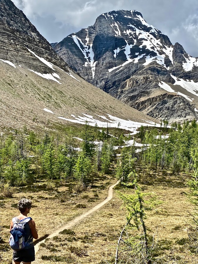
After a long, rough drive up to the TH of Kokanee Glacier PP, we start the long day hike climbing up the valley to Kokanee Lake. Mountains basking in the morning sun.
We pass many mountain creeks still flowing strong due to the large amount of winter snow still lingering in the high country.
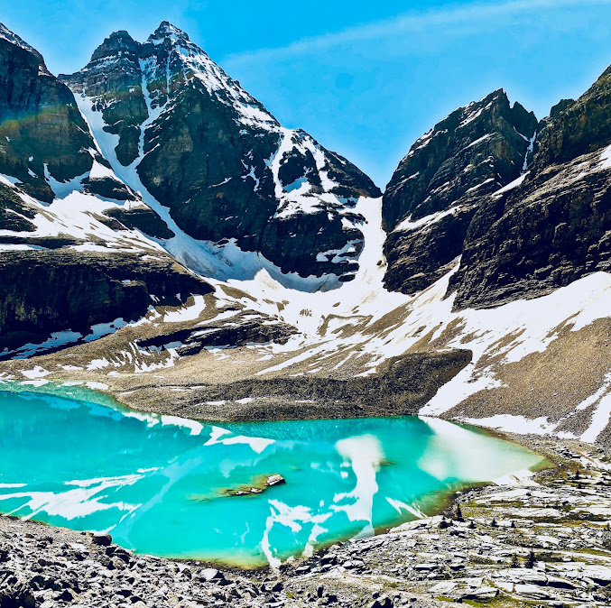
Kokanee Lake fed by glacier water gives it that distictive blue colour. Even though it is July 18th, ice still is present on the lake.
Pat checking out the competing colours of blue and green in this summer scene.
This is near the spot where in November, 13th, 1998, Micheal Trudeau, youngest son of Pierre Trudeau, on a ski trip, was swept away by an avalanche pushing him into the lake. His body was never found.
Kaslo Lake taken near the ACC mountain hut.
Lots of snow in the high country even though we are well into July.
Looking down on the ACC hut on the way to Sapphire Lakes.
Dave taking a photo of the frozen lakes and route.
One of the frozen Sapphire Lakes. We were surprised how much snow there was.
Snow had consoladated so there was not a lot of post holeing. Lots of red algie on the receeding snow.
Pat getting photos of the contrasts between rock and snow
Saw no one until we were almost back to the ACC hut.
We were supposed to keep going and complete a circle route ending back at the north end of Garland Lake but snow got pretty rotten the longer we were out.
nice view of a creek coming off the higher snowfields flowing into Kokanee Lake
Looking back on the mountains that were in the morning sun many hours before as we make our way back to TH and the long rough drive back to the Redfish campground.
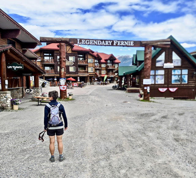
Today, we go exploring the area around Kaslo and further on to the end of the lake. Peddling across a wooden bridge on the way to some MTB and hiking trails.
A view from the bridge over Kaslo river. Mountains in the background are in the Kokanee Glacier PP where we were yesterday.
Riding was mostly blue runs. Beautiful trails following the river before climbing up past the airport and onto more trails that pass through big tree and bushes.
From Nelson, we drive over to the Dry Gulch PP campground just south of Radium, BC.
From the Dry Gulch CG, we are only an hours drive to the mountains in the Kootenay NP

Todays hike starts at the Paint Pots and crosses the Vermilion river 1/2 km from the TH.
Serious avalanche debris as we make our way up a valley with mountains of the Rockwall in sight.
Nice little set of falls on Tumbling Creek.
Working our way up the Tumbling Creek trail with mountains of the Rockwall route in the background.
Tumbling Creek crashing down some of the rock walls
Pat is smileing now but this trip, which is usually a 40km, 3 day backpack, will be a challenge towards the end of the day.
More views of the mountains which make up the border between Alberta and BC.
Tumbling Creek CG. Time for a well earned lunch.
After a long slog out of the camp ground, we break out of the forest and into the alpine on out way to Wolverine Pass.
Looking back to the Rockwall hiking route from a high point on the trail to Helmut Falls. We will pass over 25 backpackers coming from/going to Helmut Falls this day but no day hikers.
Awesome day to be hiking.
This is why they call it the "Rockwall"
Still lots of lingering snow this year which was close to a record year of snow.
The mountains of Yoho NP come into view as we head over the pass.
These are the Goodsirs which we passed by many years before when on our through hike to Jasper. Instead of following Helmut creek to the Paint Pots, we hiked up over Goodsir pass and followed the Ottertail fire access road to the Yellowhead highway.
This will be our last climb of the day before dropping down into Helmut Creek.
Nice views looking back from where we have hiked at the highpoint on the pass.
Helmut Falls. We are on a long downhill into the valley where the Helmut Falls campsite is.
Pretty impressive drop. After it seems a long time to get to the campground, we hike another few hours of up and down hiking before getting back to the Paint Pots. Total distance hiked that day ended up over 40km and 5000' elevation gain. Nice that we didn't have to carry heavy backpacks.
Looking down from "the Johnson" MTB trail on aquamarine Toby Creek coming out of the Jumbo Glacier area. When we climbed Mt. Fisher some weeks back, a hiker recommended the Johnson as a good ride.
The TH for the Johnson started at Lillian Lake. Place was packed with families due to the 35C temperatures, playing in the warm lake water. The bike trail that follows the creek canyon was the most scenic and for a blue trail, the most technical.
Views from the MTB trail looking down Toby Creek canyon into the Columbia valley close to Invermere.
Time to leave the Dry Gulch PP and the Invermere area and head to the Lake Louise area. This is the overflow RV parking spot 6 km south of Lake Louise. We have stayed here before when it was very busy. Now with Covid, the large paved lot is almost empty and no shuttles are running to Morraine and Louise Lakes.
We are waiting for totally sunny weather to hike the all day trip into Lake O'Hara so while we wait,we head out every day for some fun. This is Saddleback Mt trail leading out from the Lake Louise parking area. Pat looking across to the mountains on the east side of hwy.#1.
Lots of rain showers today so Dave jumps on his MTB and Pat straps on the roller skis and we head out on the Banff Legacy Trail, 26km of paved multi use trail between Banff and Canmore. Nice shot of Cascade mt inbetween the rain squalls. Cascade is one of the scrambles we have done a few years back.
The jagged NE side of Mt Rundle.
While Pat roller skiied up to Mt Norquay from the valley, Dave hiked up to the Stoney Mt. lookout trail that starts at the Mt Norquay lodge parking area. This is another view of Cascade.
Views from the Stoney Mt. trail
One more day of good, but not perfect weather, we drive up to the Lake Louise Ski area and park at the TH for Skoki Lodge. We are heading up in the direction of the Half Way Hut.
Looking back are fine views of Mt. Victoria, at the back of Lake Louise.
Pat gazing out at Mt. Temple on the left, Mt. Hungabee in the middle and Mt. LeFroy on the right from a ski area access road.
Today is the day we have been waiting for. It froze overnight but the weather is supposed to be brilliant all day. This is the road into Lake O'Hara. A few years ago, we hiked the road in, did the Alpine route and got a ride back in the bus. There was some smoke in the air, so the photos were not perfect.
This time, the sun will be out all day and no smoke.
The only kicker is that with the Corona virus wide spread, there are no shuttles so you have to hike in and back (22km) as well as hiking the 14km Alpine Route. Makes for a long day.
We start the day at 8:00 and stop for a food break at the campground. We were passed by a young French girl who was jogging up the road. We saw her at the campground and would not see her until about halfway around the circuit. She obviously went in the opposite direction we did.
Lake O'Hara near the lodge with the All Souls Prospect hiking route in the background. We talked to another couple who was going to hike the whole circuit in a day but after the lake, we never saw them again.
Part way up the Wiwaxy Gap with Lake O'Hara below.
There are a few sketchy exposed rock bands on the way up the first part but not too exciting.
Dave getting in a photo op on one of the rock bands on the way to the Wiwaxy Gap, which is supposed to be the toughest of the 4 section of the "Alpine route". In the background is where the "Yukness Ledges route"angles just below the cliffs heading for the big snow field.
Views of Odaray Mt across the valley.
A fine day for a hike. And no smoke in the air.
Mt Biddle at the end of the ridge. The All Souls Prospect route traverses all of the avalanche paths(snow), below the dark rock ridge ending in the upper far right where dark rock meets brown scree.
Looking out across the lodge to McArthur Pass and eventually, the Rockwall.
Trail up to the Wiwaxy Gap
Looking back down the valley from where we have started this morning from the "Gap"
Wiwaxy Peak
Perfect pass for a dual selfie. Lake Oesa below with Mt Glacier, Ringrose and Hungabee standing guard in the background.
We are probably at the highest we will get at close to 2600m, even higher than All Souls Prospect across the valley.
Looking across the valley towards McArthur Pass. We will be passing through this area in maybe 3 hours as we hike down the steep trail from All Saints Prospect.
Heading down to Oesa Lake traversing steep rock bands

Looking back at Wiwaxy Gap and Mt. Wiwaxy. Pretty rough trail down to Lake Oesa.
Rubble covering the trail down as we head towards the lake with the snow covered headwall between Mt. Lefroy and Glacier in the background.
Lake Oesa with the water coloured a stunning blue from glacier flour.
Mountains act like huge fences keeping everyone in the Lake O'Hara valley.
Unless you are an experienced climber, no way out here.
Time for lunch. You can just make out the trail on the scree heading up to the Abbot Hut. It was closed for repairs when we were there.
A view across Lake O'Hara of Mt Odaray.
The Yukness Ledges Alpine route traverses a lot of rock bands above and below.
Looking back at the way we have come. Abbot Hut is up one of those steep valleys to your left.
Lake Louise is over the mountains in the background and to your left.
After traversing some rough rock and steep cliffs we find ourselves in a valley with a number of small lakes. Opabin pass is staight ahead over the small glacier. Opabin Lake is to the lower right.
Looking across the valley at the route we took to access the Wiwaxy Gap, which are across the steep rocky bands below the east Wiwaxy Mt.
Looking over at the Mt Odaray group in the background and the All Souls Prospect route which roughly follows the snow below the dark cliffs ending where the dark rock meets the lighter brown scree in the upper left of the photo.
Fine views above Lake O'Hara.
Looking directly over to the Wiwaxy Gap and the route we hiked which is on the steep rock below East Wiwaxy Mt. and below Mount Huber which is on the right.
Pat scrambling over large boulders as she makes her way up to the All Souls Prospect trail.

Looking back at Opabin Pass. Traversing the steep snow was a bit difficult due to hard, icy conditions.
Mt. Odaray.

Not too many more snow fields to cross.
Looking across at Mt Huber and Victoria and Lefroy from All Saints Prospect viewpoint.
Opabin Pass with Wenkchemna Peak in the background.
Cathedral Mt. across the valley. We came up the valley to the right, which follows Cateract Brook.
Around to the left is McArthur Lake and Pass. We will soon have to drop down steeply to the valley in the bottom of the photo.
One never gets tired of gazing at these extremely rugged Rockies.
Last look before heading back down to Lake O'Hara, finishing the Alpine circuit and then 11km back along the gravel road to TH. After passing a few hikers at Wiwaxy Gap and a family at Opabin Lake, the only other person we saw on the circuit was the French girl, going counter-clockwise who we found out, was staying in Canmore for a few years of adventure.


 Looking out on the many orchards south towards Kelowna from Spien Kop. Provincial Parks are still closed and we can't cross the border so we spend our time hiking, biking, paddling, skiing locally. Still lots of snow on the local mountains.


 Pushing through the snow on the Mo Buddha trail. Every week we can climb higher as the snow recedes.
 Dave taking a small break at the Provincial Park sign on the way up Silver Star Mountain, a 2 hour climb from our place. Yes, that is a pile of snow where the bike is parked.
 Back to the South Canoe Bike trails trying to avoid some serious mud on "Paranoia Left".


 Mt. Odaray.
 Opabin Pass with Wenkchemna Peak in the background.


