After spending a month last year (2011)in Utah/Arizona hiking and biking the canyon country, we decided to go back again and see some of the sights that we missed. The climate and geography is so different than what we are accustomed to in BC that it is like a prairie kid seeing the ocean for the first time. This year, the hikes were longer and hotter and the biking was more intense than last year. At no time was it too hot as we were always camping over 4000' and many times above 7000'.
We are always amazed at how little surface water there is in many parts of the western states. I wonder with all of the development, where will this water come from to satisfy the needs of these new developments?
Time will tell. But I know for sure that these canyon lands area are a huge draw for tourists not only from the states, but from all over the world.
We will definitely be going back.
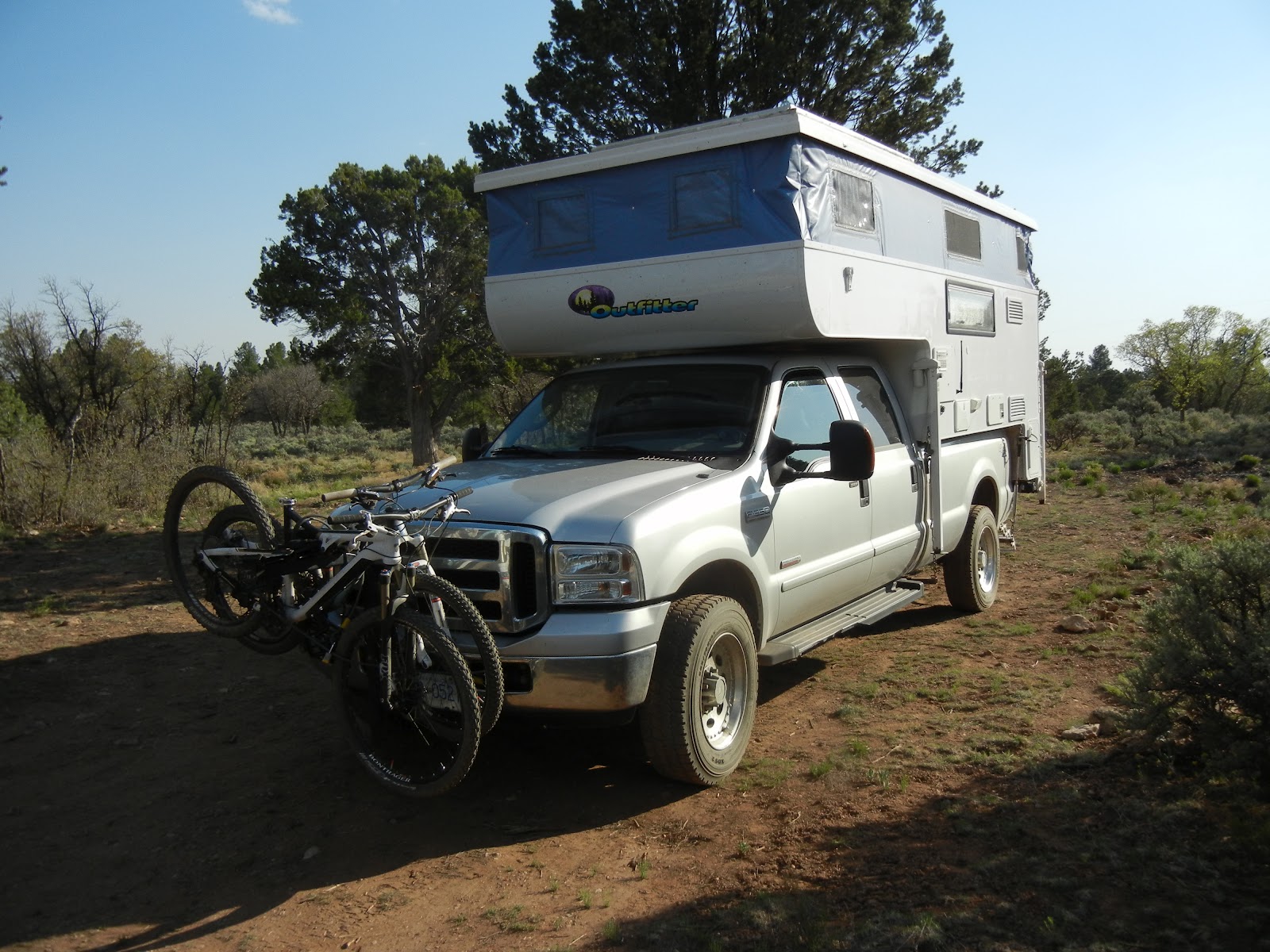
Had an average amount of snow this year, still enough to almost bury this medium size skidder. Just put on the Michelin XDS2 tires. Heading out to Moab in a few days and thought I would try them in the snow before they got covered in that red Utah clay.
![]()
Had an average amount of snow this year, still enough to almost bury this medium size skidder. Just put on the Michelin XDS2 tires. Heading out to Moab in a few days and thought I would try them in the snow before they got covered in that red Utah clay.

 |
| Today is April 23rd and we head to the Utah desert the 27th. Just finishing up a few loose ends up the ski hill. |
 |
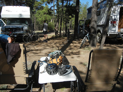
| After 2 days of driving, first night in a truck stop west of Boise, we end up in Moab on the Sands Flats camping area in overflow. There was a Show and Shine over the weekend with hundreds of muscle cars and trucks on display so everything was hopping in town. All campgrounds were full. Love the slick rock and the warmth after 5 months of snow.That's us to the right in the TC. |
 |
| Jump on the Slickrock Trail next day which is close to camping. First time trying out the full suspension bikes on these trails as last year we brought our old hardtails and got spanked. Definitely can ride stuff that we could't last year. Colorado river is not as high as it was last year and overall temps are hotter. A lot less snow in the La Sals. |
 |
| Next day we drive to Klondike Bluffs/Baby Toes where we heard there were new single tracks. After trying out the new trails we come down on the slickrock. It's like a big rock roadway. And everyday it's sunny. |
 |
| That evening we have to drive up Geyser Pass road to the La Sals and hike in the snow, Gold Basin I think. We missed it so much. Ya, right. |
 |
| Guys at the Poison Spider bike shop said you have to ride the Mag 7 trails. Drove up to trailhead off #313 and rode down to the start of Bull Run which follows the Bull Canyon. Rode down to Great Escape which runs into Little Canyon and then up to Arth's Corner. The the circle route. We start to climb back up the Bull run but Crosscheck was getting a little tired at this point and he bailed out off the run into a Juniper(dead. Well it is now) |
 |
| Trail which is to the left, follows the canyon rim almost the whole way down. |
 |
| Crosscheck working on his slickrock technique and his tan. |
 |
Crosscheck showing a little skin. Had to spend the night in the Moab hospital after OR time. An intimate encounter with a dead juniper tree left a 4" branch lodged in calf and after wrapping it with T shirt and electrical tape, had to walk 1 mile to vehicle. Lucky, the Juniper also didn't give him a prostate exam when he crashed in to it.
|

That's the piece of Juniper that broke off at the skin line. The nurse pulled that chunk out but left the other 2 pieces that broke off inside for the surgeon to take out.
 |
| Back to the campsite for a little R&R. Rode the next day at Bar M trails but Crosscheck took it easy. We are fully self contained and can last quite a number of days showering everyday as the 44 gal fresh water tank is the only thing that would be a limiting factor. Cassette toilet dumps into pit toilet as well as grey water. When we are out on BLM land, the cactus gets the grey water. |
 |
| Head out the next day to Canyonlands(Needles). Missed this last year and reports tell us its interesting country. Start out at Squaw Flats CG and head to Chestler Park overlook. As far as hiking goes, this seems quite popular as the climbs are not very strenuous as compared to the Grand Canyon. |
 |
| Mrs Crosscheck up one of the ladders linking Big Springs Canyon with Squaw Canyon. |
 |
| Getting late as we traverse the slickrock above Squaw Canyon. |
 |
| A nifty little hole in the canyon wall. |
 |
| Drive back out to #122 where we find a nice spot to camp. Lots of places along the way for boondocking. |
 |
| Back next day, leaving from Squaw Flats heading for Lost Canyon Trail from Peekaboo trail. |
 |
| No trees or bushes to bushwack through, no rain jackets or heavy winter clothing. These canyons and trails are easy going. We meet up with the Big Springs canyon trail and then back to the trail head hoping to always go on loops that we haven't been on rather than out and back. |
 |
| Back to #122 but at a different spot. As you can see this boondocking is pretty tough. Oh no, big problem, I just spilt red wine all over my evening dinner jacket. |
 |
| Met up with a Utah local(originally from SC who sounded like Eddy in National Lampoon:Christmas Vacation), who was hiking/MTB in the area. Invited us over for a fire. Got the lowdown on how Utah was doing. One thing is for sure, its got some pretty wild geology. |
 |
| Last hike, day 3 at Needles, we head out of Elephant Hill bound for Chestler Park. Those multicoloured spires ahead are the Needles. |
 |
| No one out here as crosscheck checks out the wild scenery. On our first day going back to the truck, we hiked along a dry wash on the other side of the Needles. Starting to get to know this part of the park faily well. We meet lots of people from Colorado who say that this is a nice time to hike here as it is still pretty cool where they are from. |
 |
| Our destination today is Druid Arch. Pretty massive chunk of rock when you get closer. Met a number of people hiking to the arch, many were backpacking and using this out and back as a day trip. |
 |
We got a campsite at the Squaw Flats CG. No bugs. This vacationing is a great thing. Life is pretty good around these red rocks.
|
 |
| Spent the next day driving to the grand Canyon passing through Monument Valley which we saw last year. We drove into the Mather CG and booked for 3 nights even though there are great dispersed camping in the BLM land beside the park but Mrs Crosscheck said she had laundry and shopping to do.. Next morning early, we drove out to New Hance trailhead and met a bunch of SC college kids who were on a 5 day backpack trip to Grandview. We parked truck 1/2 mile away on a forest access road and walked back to the trailhead. Started down the trail and within minutes bumped into the kids who were having a bit of trouble going down the rough parts of the trail. Mostly sliding on their butts. I thought," They sure are lucky they have 5 days because they're going to need every minute." What a neat adventure for them. |
 |
| The trail is not maintained and quite rough but as we had light packs, the trip down was fairly straight forward. Thats the thing about the canyon when I first saw it last year was the huge size and how vertical were the rock walls. How did the pioneers build trails down to the river in the old days with just picks, shovels and mules? |
 |
| We made our way down a dry wash 20 min. from Hance rapids when we came upon a German couple that had decided to turn back as it was 11 AM and as they were not at the river yet and had made plans at the start to turn back at this time. They were disappointed that they had hiked all this way down(4 hours) and would not get a glimps of the rapids.We persuaded them to follow us saying the river was not that far away. I said, can you hear the roar? No they couldn't, well either could I but that was a good way of keeping them going to the river. Eventually, you could hear the rumble of the Colorado and they were glad when we made it to the water. |
 |
| Great place for a lunch break and dip into the cool Colorado at the clothing optional beach. Said goodbye to our German friends. I'm glad it is them and not me who has to retrace their steps back up the New Hance Trail as we always try to do a loop or go where we haven't been before. No rafts today. |
 |
| Last look at the Hance Rapids as the trail climbs through lots of big boulders that have crashed down from the Vishna schist cliffs above. Meet 3 girl backpackers (doing a 3 day trip from Grandview) from Calgary, Alberta who say you're from Canada. Is it that obvious? Saw you with a MEC bag. Thats the Canadian equivalent of REI. Nice cute girls. If I was just 30 years younger I would...... Mrs Crosscheck grabs my ear and gives it a twist. Owww, that hurt. My thoughts are now focused on hiking. |
 |
| We've climbed for a few hours now and look back at the river so far down. Following Hance Creek the canyon walls drop down 100's of sheer feet to a tiny trickle of water. Getting pretty warm in the afternoon sun but thunder clouds loom ahead. We hear the first kaboom and count the seconds after the lightning. |
 |
| Water in Hance Creek. We fill our bottles, cross the creek and keep following the canyon until we reach the trail that heads up to Page Spring . The creek has so many squiggly things in it you could have a drink and a meal at the same time. |
 |
| The trail on the way to the Horseshoe Mesa passes old mining activity. The trail was original built to access the mines and mules would haul the ore up the rim to be transported to the the refinery. As you can see, the canyon is very rugged. |
 Day 15
Spend the day driving to Flagstaff which will be the furthest south we go. Great town. Get some advice from the local bike shop where to ride and so we head up to the Coconino Forest and set up camp about 4 miles from town. Friends meet us and we get ready to ride the single track trails of the area.
 We start to ride up Schultz Creek trail at 8000' and then follow the Sunset Trail till we are at 9000' and then it is time for the downhill. Whoo Hoo
 |
| Just about finished the hike. Pass a few hikers on the way up but it is when we get to the lookout at Grandview things seem a little strange. After hours of not seeing hardly anyone, the comings and goings of all the people taking pictures of the canyon is quite entertaining. Started at 8:30 and finished around 5:30. Not bad for some old farts on their first Grand Canyon hike this year that didn't do any hiking all winter long. |
 |
| We spend a day doing touristy things in the village and then early to bed for a 5:30 start. After eating, getting ready, walking down to the local bus, transferring to the Hermit Rest bus and stopping at about a hundred lookouts, we start hiking at Hermits Rest around 8:30. Weather is warmer than 2 days age with temps hitting 98F in the lower canyon. We plan to drop down on the Boucher Trail, continue along the Tonto, past Hermit Creek and then up to Hermit's Rest. Mrs. Crosscheck looks fresh now but just wait in 7 hours after all of the sun and heat.. She'll look like someone who was ridden hard and put away wet. |
 |
| The Boucher Trail follows the cliff band to the left below the light rock and above the red rock. Hermits Creek canyon drops 1000' to the valley bottom. Something we never thought about was that we will be hiking in the morning sun for the Boucher and the afternoon sun going up Hermits Creek Trail. |
 |
| This is the junction for the Boucher Trail. Looks like not many people use this trail judging by the lack of boot prints. The trail is not hard to find but it is sketchy in places due to rockfalls. The views are great. |
 |
| We could see the Tonto Trail from our lookout. Seemed like a long hot way down. We'll be walking up that way in another 4 or 5 hours. |
 |
| Mrs. Crosscheck making her way down one of the rockfalls on the red Cococino cliff bands. The old hermit Boucher had to bring supplies down these same trails. They made them tough in the old days! We pass one couple from Michigan who were doing a 4 day backpack from Hermit's Rest. They were to overnight at Yuma Point before hauling it up to the trailhead. |
 |
| Some fine views of the Granite rapids on the Colorado from the Tonto platform. Things are getting smokin hot. Not a lizard in sight. |
 |
| The cold green water below is a welcome sight after miles of brown desert vegetation. The Tonto Trail follows the river most of the way with sheer drops where you swear a guy could spit on the rafters. |
 |
| Hermit Creek above the campsite. In the high 90's, nobody was moving except to lay around in the creek. We filled our bottles, soaked ours shirts and headed up away from the creek on the long grind in the sun to Hermits Rest. |
 |
| Looking back down to the long traverse and switchbacks from the Hermits Creek CG. Found a few patches of shade. At 3:30, the rocks were too hot to touch. This is when I started to dream about those weak, cold Yankee beers that I had put in the TC's fridge. After hours of drinking gallons of warm water from the camelbaks, cold beer is almost my favorite thing. |
 |
| We stop for a breather at Santa Maria springs. Stuck our heads in the trough, soaked our shirts and watched all of the squiggly things that were living in the water. I guess in the desert, any water is good water(as long as it is filtered and treated). Make it back to Hermit's Rest 6:30 feeling fried from the sun. Drink gallons of water on the bus going back to our TC. All I could think about was cold beer. |
 |
| Meet up with friends a few miles out of Grand Canyon Village in the Kaibab National Forest. Temps in the high 70's during daytime and down in the high 40's at night. No furnace, no A/C. Perfect camping weather.Our 190W solar can keep up with the charging of the batteries even though we have an all electric fridge which seems to need more juice the warmer it gets and as we shower every day, Mrs. Crosscheck has to have her hairdryer going for a few minutes a day. We're in a dry environment, just stand out in the wind I tell her and your hair will be dry in no time. Yup, she gives me that look again. Why do women always have to have a hairdryer? Still no genny time and this is day 12 since we left Coldstream BC. |
 |
| Take our friends for a short hike in the canyon as one of them had never been there before. |
 |
| Next day we decide to make a flat day ride on the Arizona Trail which happens to pass by not too far from our campsite. |
 |
| The girls are ready to ride the Arizonal Trail. We pedal 15 min from our boondock spot to an intersection with the Trail. Looks like we will follow the track through Tusayan and then to the Village. Officially the trail continues down Bright Angel Trail but bikes are a no no. The first part is a single track through the pines and then all the way to Tusayan, we then follow sandy, forestry/ranching roads. Meet one other guy hiking. He is doing the whole trail in sections. Go under #64 north of Tusayan, past park entrance and then into Village. Ride out to Hermit's Rest stopping at all of the view points and then back to our campspot 12 miles east of GC village. We ride about 80km's for the round trip. |

Spend the day driving to Flagstaff which will be the furthest south we go. Great town. Get some advice from the local bike shop where to ride and so we head up to the Coconino Forest and set up camp about 4 miles from town. Friends meet us and we get ready to ride the single track trails of the area.

 We drive back to Grand Canyon that evening a grab a good boondock spot between Tusayan and the Village. Tommorrow will be our last hike and because of the heat, we will be up at 4:30 and because of the bus situation, we will still not be away as early as we would have liked to. This is the longest of the hikes(25miles) and we are setting off at Hermits Rest again and ending up at Bright Angel.
 |
| These small ponds are called "tanks" in cattle country. They have small dams which collect runoff ground water for the cattle. Things you learn when on the road. |
 We drive back to Grand Canyon that evening a grab a good boondock spot between Tusayan and the Village. Tommorrow will be our last hike and because of the heat, we will be up at 4:30 and because of the bus situation, we will still not be away as early as we would have liked to. This is the longest of the hikes(25miles) and we are setting off at Hermits Rest again and ending up at Bright Angel.

Get a good start at 6:40.We meet a couple from Pa. who are heading down to Hermits Creek for a few days. He's the mule and she's the one who has jam to travel all the way down and back in that heat.
 |
| Meet some backpackers coming up Hermits who decided because of the heat to start early or camp part way up the trail and beat the heat before noon. We find it quite pleasant compared to when we came up the trail in the hot afternoon sun a number of days ago as we are mostly in shade all the way to the Tonto Trail. We stop long enough to watch the rafts run Granite Rapids. Must be fun in those big inner tubes. |

As we walk along in solitude on the Tonto we run into a large group of day hikers. We find out that they are part of a commercial rafting trip and they are hiking from Monument Creek to Hermit Creek while guides run the Granite Rapids. Its getting pretty warm now but there is a strong wind, keeping things reasonable. Catch sight of this column which is why they named the creek that way.
 |
| We stop for lunch at Monument creek and climb back up the the Tonto. Great views of the river most of the way. Pass Cedar Creek, no water. On to Salt Creek. We meet no one on the Tonto until we get to Salt creek where we met these 2 guys hiding out in the shade. They were on a 4 day backpack trip and they were waiting for the sun to set before heading out. Dipped our bottles but because of the salt content we were not going to drink any of it unless desperate. We knew that Horn Creek was contaminated so Indian Springs was the only water source. Man, was it getting hot. |

After rationing water for a few hours we hit the oasis of Indian Gardens. We guzzle that wonderful cool water, chat with other hikers and start the last climb to the top. We were surprised how much shade there was and how easy the climb was. Bright Angel has hiker friendly grades and we were up top by 5:00 .
 Camped that night in the Kaibab Forest and drove to the Red Canyon next day where we stopped in the CG. Weather was getting chilly after all of that canyon heat, wind was howling and we had to put on our Mackinaws sitting outside..(thats coats for the uneducated)
Next morning we broke camp and parked at the tourist info centre. From here we hopped on the MTB's and peddled up Thunder Mountain. Wind was howling and temps chilly. Met a young couple from NC who we had met cycling in Flagstaff a few days earlier going the other way. Small world. Pretty amazing red colours of the Hoodoos.
 The highest point we get to is White point where we have a great view of the different pastel colours that the Red Canyon can come up with. From here, it's downhill all the way to the tourist info centre. Whoo Hoo!!!
 Drive on #12 till we get to the tourist info centre in Escalante where the old wind and rain, yes I said rain is falling. Lady at the desk said the front was going to pass through by tomorrow so we pick up a few maps and head out on the Hole in the Rock road and camp just off it at Egypt Bench Rd. This was to be our home for a number of days. We drop the Outfitter as some of the roads we will be exploring on are rough and quite sandy.
 Our destination today is the Golden Cathedral. After hiking an hour or so from the trailhead, we come to the Escalante river where Mrs Crosscheck is walking across. In BC especially at this time, no creek would be able to be crossed like this as it would be too cold and too high let alone a river. Pretty dry country in Utah. You wonder how the Mormons survived and flourished when they first settle in the area.
 After crossing and walking in the river a number of times we head up Neon Canyon. Pretty cool pink and red smooth shape canyon walls.
 We have arrived at the Golden Cathedral. Light shines down from above through holes in the ceiling and lights up a pool of water below.
 Crosscheck talking to the canyon gods hoping he can atone for his many years of sin.
 Heading back down Neon Canyon and back to the truck.
 Got the place to ourselves. Well, and a few chigars, ants, no seeums.Temps are rising and the solar keeps up but not a lot of battery power left by morning. Think I'll add another 100 watt panel when I get the chance.I can hear George the Generator(behind the rear lower door) pleading to be let out in the bright sunshine so he can sing his little tune but haven't needed him yet and it must be close to more than 20 days since we left home.Yay solar.
 Today, it looks like a fun trip to Peek-A-Boo, Spookey, and Brimstone Gulches. A fair few folks around. We head up Peek-A-Boo first. Lots of tight corners and pink and peach pastel coloured walls.
 These shapes and colours are so sensuous.Its putting me to sleep.It almost reminds me of a colonoscopy video that I saw at the doctors office.
 We leave Peek-A-Boo and hike down into Spookey.Mrs. Crosscheck slithers down a short opening caused by a large chokestone. We meet one other couple and later on I can understand why only lean people need to apply.
 It starts to get a little tight the farther down you go. And real scratchy for my tender skin. We eventually get spit out but it was very Spookey for awhile.
 The partial eclipse of the sun was happening one evening and as I couldn't find my welding goggles or proper sun gazing glasses, I rigged up my patented ,small hole in the end of an empty beer can viewing one. Mrs. Crosscheck is still seeing dots a month after trying it out.
 We drive to the trailhead of the Crack in the Wall trail. We look down on the confluence of the Escalante river and Big Hollow Wash. Across the river is the Steven's Arch.
 Crosscheck climbs down at the Crack in the Wall. This is a small slot where a large slab has broken away from the main canyon wall allowing one to go down the face, a descent without ropes.
 We are now walking up Coyote Gulch where a small creek and a number of waterfalls greet us as we make our way up. Cliff Arch, Coyote Bridge and final destination Jacob Hamblin Arch are some of the sites we will be seeing.
 This is one of the few year round creeks in the area making the canyon a popular backpacking trip.The going is easy and cooling as you are in the water most of the time. We are told by a young couple we met at Spookey that they hiked to Hamlin Arch and then climbed out of the canyon and back to their vehicle. The walls look so high and sheer we wonder if we are going to be able to get out without a helicopter.
 We pass under Coyote Bridge
 Hamlin Arch. There is a very nice campsite by the river approximately half way between Huricane Wash trail head and Crack in the Wall.
 There is a short,steep climb out of the canyon. It looks like if we didn't know it was here, we'd still be hiking up the creek. Once we get to the top, the GPS is set for the truck and we go cross country for an hour and we're at trailhead.
 Spend the last night at Hole in the Rock road, load the Outfitter and drive towards Goblin Valley. We pass through Capitol Reef NP which was smokin hot and then on to the dispersed camping area near Bell and Little Wildhorse Canyons. We missed these little gems last year and on recommendation from friends, decide to do the loop early next morning. All the crowds leave the nearby parking area and we are left all alone.
 Our hike starts early as we know from seeing people from all over the place that these gulches are well known and we want to be through them before the crowds get there.Hike up through Bell and then as we head down Wild Horse we see our first hikers. This is the most interesting of the 2 gulches and that is why we see so many hikers toward the bottom.
 The walls tower above you as you follow the curves of the Wild Horse canyon that flood waters have sculptured.
Pack up and start the drive to Fruita CO. Winds have been very strong today . Friends who had biked there said that the MTB riding was more "flowey" than Moab. We were soon to find out. We found a camping spot at 18 road which the BLM people were going to start charging fees for but when we were there nobody seemed to be paying anything. Did a short run down Kessel in the evening after a few adult beverages. Took some nice pics of the sunset.
 Winds have been very strong today . Friends who had biked there said that the MTB riding was more "flowey" than Moab. We were soon to find out. We found a camping spot at 18 road which the BLM people were going to start charging fees for but when we were there nobody seemed to be paying anything. Did a short run down Kessel in the evening after a few adult beverages. Took some nice pics of the sunset.
 The single track looked very flowey, so different from Moab. Almost looks like we were back in Tanzania. Is that a lion underneith that tree. I gotta stop mixing Scotch and Tequila.Looking forward tomorrow hitting the trails.
 Crosscheck chugging up Joe's Ridge. Start was a ride up to PBR then down to Prime Cut, crossed Zippidy-Doo-Da up Western Zippity,along Frontside and down Joes Ridge. Very nice trails.And no blood was spilt.
 Wind is constant as we pack up and head down I70 just across Utah border to a little place called Rabbit Valley, a well known offroad area which people had recommended MTBing. We notice that the the LaSals are hazy and at first we thought it was smoke but with these strong winds, figure it must be the dust in the air. Pull into a small BLM campsite 1/2 mile from the highway. Notice a few tents that are not looking so good in the wind.
 Jump on our bikes and head for the West Rim trail.You ride up for an hour through dirt and sand then everything levels out on slickrock. Mrs. Crosscheck makes sure not to get too close to the edge as its a coupla hundred feet to the bottom.Across the canyon the trail continues so we'll be by that area in 20 minutes.
 We are across the rim from where the last pic was taken. Lots of trails down below. Meet three guys from near Denver but they turn back after a few fotos. Wind is gusting to 30mph and we have to be careful if you stand too close to the rim ya might get airborn.
 Leaving the West Rim trail we follow the Kokopelli bike/jeep trail, that, links Fruita with Moab and head back to the trail which will take us to the truck.
 We look down on one of the sections we have just been on. There are nice views of the Colorado River along the Western Rim.
 We ride the Kokopelli jeep road which is filling up with sand in this wind down to the trailhead past the Castle and the Beehive. A big bullsnake crosses in front of us and I grab its tail but Mrs. Crosscheck tells me to drop it and it motors over the sand and away. She hates snakes.
 Spend the night in a howling wind storm. We do fine but the tents around us have to pack big nuggets inside to keep them from being airborn. Must be a front moving in. Start heading home. Stop in SLC for some shopping. Temp is 48F. Was 80F at 8:00AM when we left the campsite that morning.Temps keep dropping and we start picking up snow north of Idaho Falls.Mrs. Crosscheck is concerned about snow staying on the road surface and I said that it is late May, the roads are too warm for the snow to stay. Well, the higher we went up the more the snow stayed on the surface. Plows are pushing snow most of the way to Butte where at 10:00PM, we stop at a rest area and sleep. This is a shot of the morning. Say good by to our early desert summer.
After crossing into Alberta and following the Cross Nest Pass route we stop on the BC/Alberta border and camp at a small lake. No one is around.Wind is blowing, it's quite chilly and it feels funny to see snow in the mountains, trees as far as you can see and water that is not damned,ie natural lakes.
 As we get closer west into BC, the weather gets warmer. Pass Creston,turn right and head up twisty #3A towards the Balfour ferry. Stop for lunch at a little boat launch and looking at the green mountains and blue lake we marvel at what a difference a few days can make when you travel.

We board the Balfour ferry to cross Kootenay Lake with a mixed bag of locals, motorcyclists, tourists and loggers.
 From Balfour, we take twisty #31 past Kaslo and to the head of Kootenay Lake where the road turns to gravel and we follow the Lardeau River which is smokin from the spring runoff. Climb above Trout Lake and hit pavement again as we head to the Galena Bay ferry which crosses the Arrow Lakes. The Selkirk Mts. still have a lot of snow on them.
 One more picture of the Selkirk Mountains from the Galena Bay ferry on the Arrow Lakes.
 |
Pull into Revelstoke to visit our son. Locals call it Revystuck because of the number of times the Rogers Pass is closed during the winter for avalanche control between Revelstoke and Golden. But where there's lots of snow and mountains there's lots of sledders, skiers, boarders. World famous "Selkirk Champagne Powder". Head back home next morning on hwy#1 to our little place in Coldstream. We have just pulled into the driveway after 3 days of moderate driving, tired enough to need another vacation , just any place so I don't have to cut the grass.
|
It's nice to be back home but travelling and seeing new places still has to be the best part of life. We drove 7500 kms. and spent $120.00 on campsites. Ate 0 meals in restaurants or fast foods facilities. Drove out of the driveway April 27th, 6:00AM and arrived back May 29th. Hottest temp. was 100F, Tonto Trail, Grand Canyon. Lowest was Montana 32F. Generator time= 20 min. to let George exercise a bit and sing his little tune to the Junipers. Minor inconvenience (5 min. search)getting into the states. No problemo coming back through into Canada.
All in all, we had a great time and got a great tan. Thank you Utah and Arizona. We'll be back.
Dave