After a long drive from Coldstream, turning left at the Needles ferry on the Arrow Lakes and a rough drive on logging roads, I finally make it to the road that takes you up to Monashee Park the back way. The road from Cherryville has been washed out so this is the closest way a person can get to Mt Fostall. Park the truck, shoulder the pack and hike in the early evening about an hour and set up camp. Beautiful evening although it is starting to cool down. Takes a few minutes to put up a tent and soon I'm sitting around a roaring fire. Got the place to myself and my buddy Ruudie.
|
 |
| Brought my full kitchen with me. This setup is good for 2 nights or 20 nights. The MSR Dragonfly has never let us down. |
 |
| Yummy. What would the world do without Sidekicks? |
 |
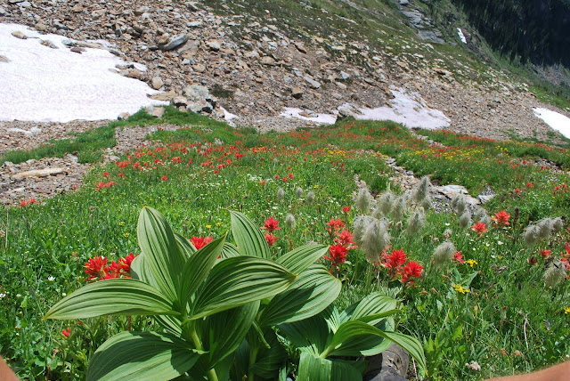
| The old worn boots are lookin for some action tomorrow. Flowers are all out and bugs are gone. Easy going. |
 |
| Mt. Fostall in the morning light. It's not the most rugged mountain in the universe but being the highest in Monashee PP, it is supposed to have great views. |
 |
| Looking down on Big Peters lake from Caribou Pass. Little Peters Lake is just to the left below Slate Peak. |
 |
| There was a good frost last night and the snow at the pass is still pretty hard. If I went much further ahead without an ice axe, the rocks would beat me up pretty bad by the time I hit them. |
 |
| Looking south west. |
 |
| Ruudie relaxing on one of the snow fields on the way up to the ridge. His shaggy, debris filled coat was cut in June and he's still growing the fur back. |
 |
| Looks like we've made it to the peak. Only 1.5 hours from my camping spot. Pretty easy going but such a great view and the late Aug. day is warm, sunny and almost no wind. |
 |
| Good views of Mt Odin, Thor and The Peters Lakes. Looking kinda north east. |
 |
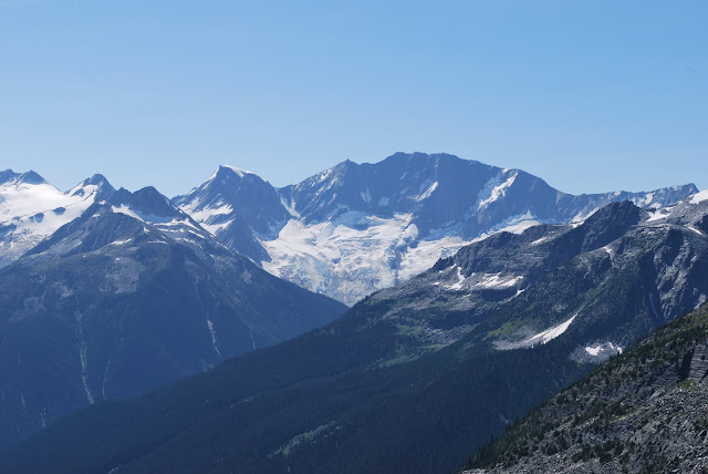
| Revelstoke is over those mountains in the background. The PP boundary is just in front of the peaks on the horizon. |
 |
| There's the old guy on the top thankfull that most of his parts are still working. |
 |
 |
| Slate Peak is the mountain in the park with the avalanche shute the ends up at Little Peters Lake. Hiked in that way in July when the road was washed out passed Sugar Lake. |
 |
| Looking at Mt Odin(peak in the cloud) which is passed Fawn Lake |
 |
| Looking across at the Twin Lakes area(in the back ground) |
 |
| On our way back down through the alpine flowers. |
 |
| One last look at the alpine lakes. Margie lake is barely visible on the extreme right. |
 |
| Packing up the tent and heading down the mountain. |
| Get some fine views of Mt Tupper on the way up the Hermit trail which is quite steep |
 |
| We arrive at the tenting area which people base camp out of to climb Tupper, Rogers and Sifton. |
 |
| Mt Rogers. The glaciers are just behind the rocks. |
 |
| Nice views of the Illicilliwaet Glacier and the Asulkan valley across the way. |
 |
| Looking down at #1 Roger Pass |
 |
| Mt Sir Donald |
 |
| Working our way up the saddle between Mt Rogers and Sifton |
 |
| This is late Aug. and still lots of snow around |
 |
| Looking back at from where we have just come up. |
 |
| Shane and Ruudie soaking up a few rays as they check out their surroundings |
 |
| Mt Tupper |
First sighting of the north mountains from the saddle. We plan to mt bike Keystone basin tomorrow. It is behind those mountains somewhere.
 |
| Looking west into the Monashhees and on the shoulder of Mt Sifton. |
 |
| The pointy one is Mt Sir Donald with Illicilliwaet Glacier to the right. |
 |
| Mt Sifton |
 |
| And the Monashee/Selkirks go on forever. |
 |
| Looking down on the way we just came. Tupper to the left, Sir Donald to the right and the Rogers Pass highway somewhere below in the valley. |
 |
| Shane making his way down the rockfall to the snow. |
 |
| Mt Rogers |
 |
| Ruudie taking a cool break on the way down. |
 |
| Shane doing a little boot skiing. |
 |
| What a wonderfull day to be out in the mountains. Shane and his buddies come back in the winter and back country ski all of the steep slopes. |
 |
| Rogers Pass below as we prepare to drop into the trees and the steep switch back trail to the bottom. |
 |
| Drive back to Revelstoke where we meet up with Pat and a girlfriend she brought from Vernon. Looks like we 4 will go to Keystone Basin tomorrow for some biking. |
 |
| Flowers are out and the temps are around 20C. Lake Revelstoke is below us in the valley. The Mica dam is further north(right) which is backing up a huge reservour lake. |
 |
| Dave working his way up the trail with the Monashees in the background. |
 |
| Sandra in next. |
 |
| The girls chatting as usual. They are some strong dudettes!!! |
 |
| Pat's commin around the corner still climbing to the pass. |
 |
| Great lunch spot at the high point. We have already been to the log cabin further on in the basin. Lots of mosy's and back flies. |
 |
 |
| Nice views of the flowers as we have lunch . |


