Stein Traverse is really a 7-10 day hike from Liloowat lake to Lytton. I only had 6 days and there was no possibility of a shuttle so for me it was an out and back. Quite impressed with the scenery and I have been to a lot of mountain area. I would guess out of 10, this would rate as an 8 for ruggedness, scenery, wilderness length.
|
|
| Ruudies pretty game to go for a hike in the mountains. Pat decided to stay at home and ski train for the upcoming Masters World Cub of cross country skiing in Asiago, Italy in Feb/2-13. Her loss our gain. |
 |
| This is pretty typical of the bush in this area which is classified west coast rain forest. Lots of moss clinging to the trees, steep mountains, lots of small creeks thundering down the canyons. This is early September so the water levels are low but in the early summer, the creeks are uncrossable unless you have a bridge. The logging road going up the the high country have been destroyed in 3 places due to flooding. |
 |
| Lizzie Creek. We will be following this creek for a number of hours up to it's start at Lizzie Lake. Had to carry Ruudies pack for him across creek and hold his collar because he would have been swept away for sure downstream. |
 |
| Stop for a break after a couple of hours at Twin Two creek for lunch. Look who's in skinny dipping. |
 |
| You can make out Lillowat Lake way down in the valley close to where we started a number of hours ago. Looks like bear country being so green and lush. |
 |
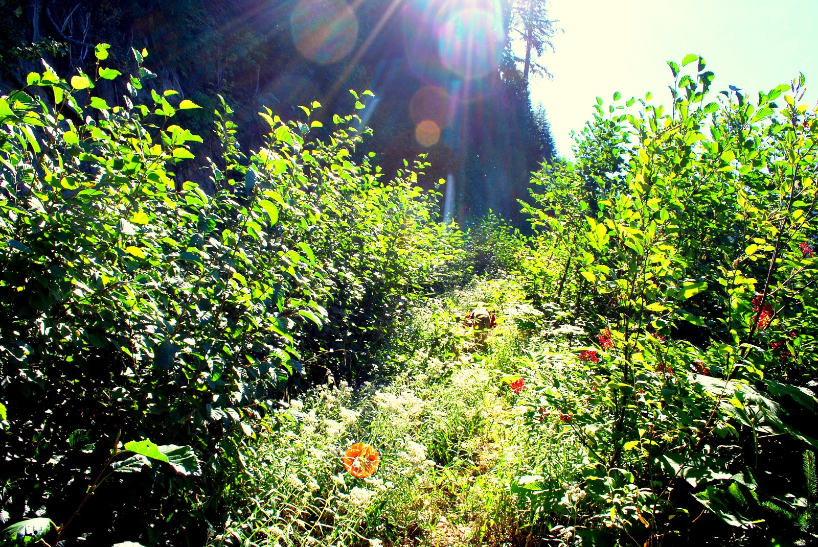
| Before the floods of 2006, the hiking trail that you see in front of you was a rough logging road that 4X4 vehicles could drive all the way to Lizzie Lake cutting off as much as 8 hours off the trip. Now the fast growing plants are starting to reclaim the road. You can hardly see Ruudie in the slide alder bushes. |
 |
| Arrive at Lizzie Lake and after a short break, head past an old campsite and follow a trail that climbs steeply above the lake. Lots of blow down, some cut, much left to crawl over. |
 |
| Pretty tough getting yourself and a heavy pack over this wind fall. |
 |
| Gates of Shangri La. We have to negotiate a big rock pile filled valley on the way to the Lizzie Cabin. You can see the alpine area at the top of the picture. |
 |
| Lizzie cabin built by David Nickerson in the 1960's. A little run down but still appreciated for some shelter when weather is less than fine. I plan to bunk out here as it is September and the biting bugs have gone to sleep. Usually cabins are full of bugs in the summer and a tent with netting is preferred. |
 |
| Nickerson spent many a year in his area creating new trails and brushing out old ones. Had a great sleep. Thank you Dave. |
 |
| Have some supper, split some wood for a fire and settle back and enjoy the cool evening. It was a tough climb up. Glad I had put in some pack packing trips before as this one is shaping up to be a doozy. |
 |
| First glimpse of Arrowhead lake after another very steep climb from the cabin. We are now in the alpine and will remain that way until we are on our way back. |
 |
| We are in the coast range where snow, rain, sun, white outs can all be counted on in any month. So far we are lucky. |
 |
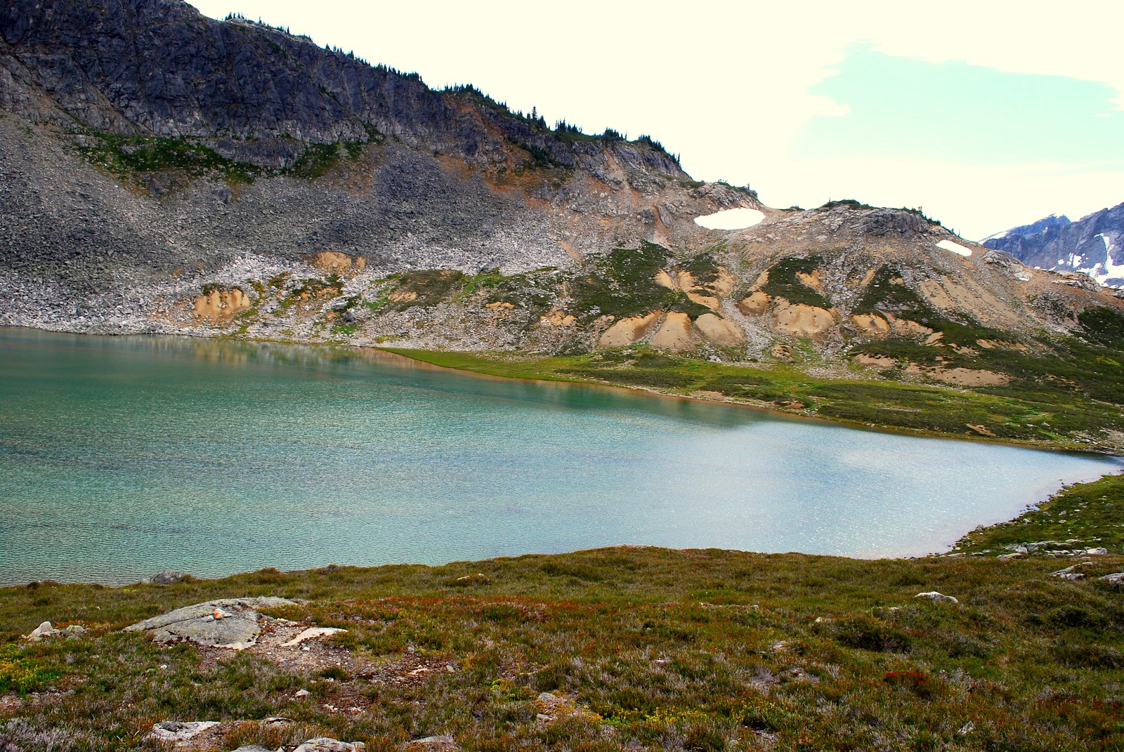
| Iceberg Lake. Da ya think that water is a little cold? |
 |
| Looking back west. |
 |
| Caltha Lake in the distance which is our destination today. We start out on a side hill thinking this is the easiest way to go but the trail actually starts off on the ridge above us and will head over higher than where we are going. Later we will be on steep, slippery wet, grasses which with a full pack makes for lots of wipe outs. |
 |
| Caltha Lake. After a tough 3 hour side hill slog, we make it to the lake. Drop our gear set up the tent have some grub and hang the food. Thought a little hike up to the pass for some photo ops would be nice even tho Ruudie and I are tired. |
 |
| After a 1 hour hike from our tent site,we reach the pass which is the boundary for the Stein Valley PP. |
 |
| Tundra Lake. Yes, it is as spectacular in person as it is in the photos. Notice that the mountains in the back ground look dryer than where we have just come through. Those are getting closer to Lytton which is in the interior dry belt. Many times, in BC because of the mountains, climatic zones change quickly not only when you rise in elevation but also which side of the mountains you are on. |
 |
| Somebody is happy to have their pack off. |
 |
| Ruudie's relaxing on natures A/C. Tomorrows trip will be up over the same pass, down to the lake and then a hard slog over rock falls. Supposed to be tough. |
 |
| A view of Caltha lake on the way back down to the tent. Even though this is a fairly popular route as is not too far from the lower mainland population, this is day 2 and have not seen anyone. |
 |
| This is our first night of setting up the tent. No rain yet although there are clouds coming in. |
 |
| Surrounded by the coast range as the clouds roll in. |
 |
| Heading down to the lake after hiking up to the pass. Ruudie and I have a tough walk coming up over boulders the size of VW's. |
 |
| Looking back up past the rock fall to the pass above Caltha lake. The picture does not due justice to the size of the rocks and the angle that they are at making it quite difficult to traverse especial when carrying a heavy pack. |
 |
| Climb up the rocks above the lake, much easier than before. |
 |
| Lots of snow covered mountains ringing Tundra lake. |
 |
| Spectacular scenery above the tree line as we head towards Stein lake which is in the valley south of the mountains in the background. |
 |
| We are supposed to be to the right and much higher on the ridge. Our route is to traverse the slope and head for the avalanche slopes in the centre of the photo. In the end, it will be a tough slog to traverse the steep slopes. |
 |
| The walk along the ridge behind us was surprisingly rough. Maybe we were tired or it was cuz the clouds are coming in but it looks like a good time to get off the ridge which is very exposed. |
 |
| Puppet lake. It is a steep rough drop down to the lake and I didn't know that there was a trail down so it made things more difficult that it should have been. |
 |
| Not long to go before camp will be set up. The clouds are moving in and it looks like snow. Ruudies looking at getting some sleep time by a fire. |
 |
| Drop the packs, drop a few snags for the fire, get a nice one started, then the wind picks up and the snow starts falling. I want my mommy. |
 |
| Got to bed early that night as the wind howled. Glad I never had to stay up on the ridge or things might have been different. Woke up to some white stuff. Ruudie was on bear watch in the bushes close by. |
|
|
| Not bad scenery right off my back porch. This is day four of the hike and as I am not going through we will head back the way we came. Stein lake is below us and that would be a tough day to go down and back. Because I don't have anyone to shuttle me, this is a 6 day stay up in the alpine style of hike in the Stein. |
 |
| Looking down on Stein lake from the ridge above Puppet lake. To continue the hike, you have to go along the ridge , drop down to the east end, then follow the Stein river all the way to the end where it empties into the Fraser river neat Lyton. |
 |
| Leaving Puppet lake as we head up the trail to the main ridge. |
 |
| Lots of glaciers on the mountains across the valley as we head back retracing our steps. |
 |
| Tundra lake through the fog. A return route is easier to see now we have been on it. We will take a different route going back. One thing you realise is that it took 3 long days for a fit person to get to where I am now. Being alone, except for Ruudie if something happened that was an emergency, help would be a long time coming. Cell phones do not work here and although I carry a SPOT device for emergencies, you might just be SOOL. |
 |
| Stunning views from the ridge as we head toward Tundra lake. |
 |
| Great views of Tundra lake and the coast range in the background from the throne at the campsite.Stopped for lunch here. It was a long slog traversing the rockfall along the lake but this time I kept higher and things were not as tough. |
 |
| Last look at the route we took both coming and going. This time we stayed a little higher along the rockfall beside the lake and progress was a little easier. |
 |
| Ruudies always enjoys the snow. Heading over the pass on the way to Caltha lake. |
 |
| Reach an area above the lake where there are trees for the fires. Trying to setup tent in a snow squall. |
 |
| Glad I got the tent up and the fire going as we are pretty tired from scrambling up and down the ridges and fighting our way over the rock falls. While some of the Stein Traverse has some sort of identifiable trail, most of it is route finding. |
 |
| Poor old Ruudie. He's such a trooper. Negotiating those big boulders, some as big as a small car, was hard for his short legs. He dug himself a little bed and hit the hay. |
 |
| The clouds start to lift at sunset but I can feel the temperature dropping. There is going to be a hard frost tonight. |
 |
| I can see the route we will take as the clouds lift. It will mean that I will start off higher tomorrow and follow the ridge before traversing over toward Iceberg lake. We will be headed for that snowfield in the upper right of the photo just below the high point. |
 |
| Very nice evening above the lake. Haven't seen a soul since setting out 4 days ago. As you can see, we are almost above treeline so fire wood is not readily available. I have been harvesting wood for fires these last many years with my trusty Coughlans aluminium, folding bow saw. Replaceable blades can be had at any hardware store. It has provided wood for 100's of fires through out our hundreds of bush trips in the last 30 years. |
 |
| You just can't back pack unless you have a nice warm fire. Not that long ago, we used to carry an expanded metal grate so we could cook over the fire but with all of the regulations in some national and provincial parks, fires outside of major camp grounds were sometimes forbidden so we gravitated to multi-fuel stoves. |
 |
| Here's Dave looking like he could scare a grizzly off a kill. I am wearing all of my gear even sitting around the fire as there is a chilly wind coming off the glaciers. |
 |
| Next morning my 2 litre water container was 3/4 frozen, solid as a rock. |
 |
| My 2 season tent works well in the warmth of summer and if you don't camp in the fall at higher elevations and I have a medium down bag. Me and Ruudie where snuggled up all night although he shivered most of the time. |
 |
| Morning brings sun even though it might only be be for a short time. Had to hike up a ways with all of my kitchen stuff so I could eat breakfast in the sun that was just clearing the mountains. |
 |
| Nice view of the ridge that we will be following on the way back. The green area where we traversed looks easy but in reality it is quite steep and slippery especially with a heavy pack. |
 |
| As we get higher up the ridge, you can see a very small piece of Iceberg lake in the centre of the photo. The route will take us above and to the right of the lake before heading down to Heart lake. |
 |
| Last look south at the coast range . |
 |
| Table Top mountain. Should have climbed up to the top for the views but Ruudie and I were on a mission. Planned for 6 days and looks like we will be down today which means a horrendously long day(2 days in 1) and no stopping. |
 |
| Come over the ridge and can look down at heart lake. Liloowat lake is way around the corner. I didn't know it at the time but Ruudie and I will make it down to the car after dark and still have to drive the 5 hours to Coldstream getting in at 3:00am. |
 |
| That's the route we take kinda following the valley as it drops down to Lizzie lake. |
 |
| You can just make out the cabin in the centre of the photo. The rocky canyon that takes you to the traverse over looking Lizzie lake is called the Gates of Shangri La. |
 |
Dead tired Ruudie waddling down the overgrown logging road. We still have to ford the creek when it was dark and it was a little tricky because with the strong current, it was not easy to cross carrying a pack and holding on to Ruudie's collar so he didn't end up in a log jam. Found out that the skin was warn off his pads I think when he was walking over all of those sharp granite boulders along Tundra. lake. Like I said, we did 2 days in one but hey ya only live once.
I have been on longer trips but because of the nature of the terrain, this ranked up there in difficulty. |


No comments:
Post a Comment